Getting Lost in the Scottish Wilderness
June 2006
A version of this article has also been published on the Search and Go website at: http://www.searchandgo.com/articles/recreation/scottish-wilderness-1.php.
|
What does 'wilderness' really mean? It only makes sense as a relative term - for instance, there is nowhere in the British Isles that can compare to Antarctica for an environment that is genuinely wild, in the sense that man has had minimal influence over it. There are however, parts of the British Isles that are wild in the sense that they contain no man-made structures, are only accessible by very long trips on foot and provide a haven for a small number of animals [see another of my articles about this] that require the absence of man. The north of Scotland contains the wildest, harshest and most remote environments in the British Isles, and as such these areas represent the greatest challenge for anyone venturing into them for whatever reason. There are large areas that are today completely uninhabited, although historically many of these areas were once well populated. The Scottish wilderness is in some ways not a relic of some mythical unspoilt past where nature held sway, but is in fact a testament to a more recent unsavoury event inspired by the worst of human impulses, namely the Highland Clearances.
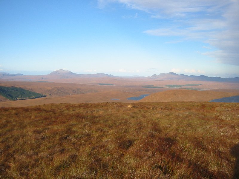
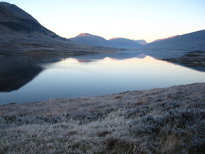
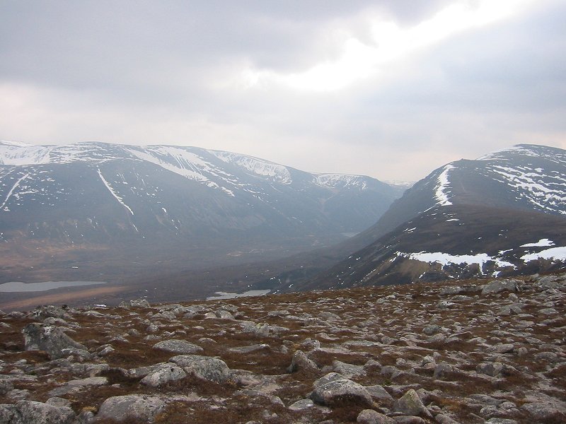
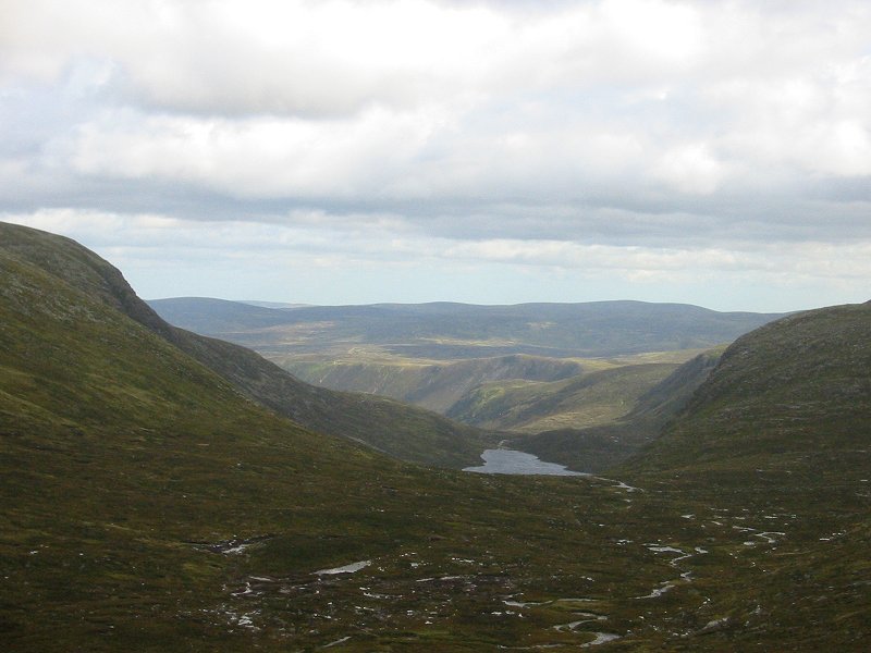
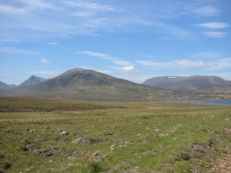
Leaving aside questions of whether one should feel guilt at the thought, it is very fortunate for modern inhabitants that such a relatively accessible wilderness exists in the British Isles. Perhaps the most outstanding wild landscape, the Cairngorm Mountains, offers large areas of land at the highest altitudes to be found. Despite the presence of a developed commercial skiing centre in one corner of the Cairngorms, the impact of modern civilization is minimal and the area so vast that it is possible to walk for days without seeing anything of civilization. Further north, Letterewe offers one of the largest areas in Western Europe with absolutely nothing in it - no roads, bridges or farms; empty of everything but rough mountain slopes and rivers that require fording. The moors of Sutherland and Caithness do not even have the large number of mountain summits that land further south has, and hence do not attract the same number of walkers and mountaineers, further increasing the emptiness. Here then, is true wild land. To stand at the edge of a desolate area like this and contemplate walking across it with the prospect of meeting no-one for days, of having no contact with the outside world (you can forget about mobile phone reception), and to carry enough on your back to be self-reliant until you get back to civilization requires nerve and preparation, but is undeniably exhilarating. Some of these remote areas in the Scottish mountains, particularly areas like Letterewe or the large unnamed area in Easter Ross between Loch Broom and the Dornoch Firth, are so remote and unvisited even by walkers that to attempt to cross them in the depths of winter would require the same level of preparedness and willingness to suffer that would be required if one were to enter into the Canadian Arctic or Siberian wastes. The only difference perhaps being that a gun is not required to ward off polar bears.
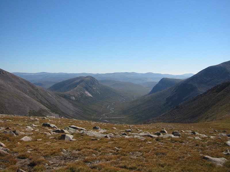
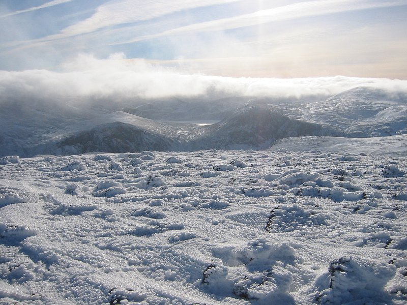
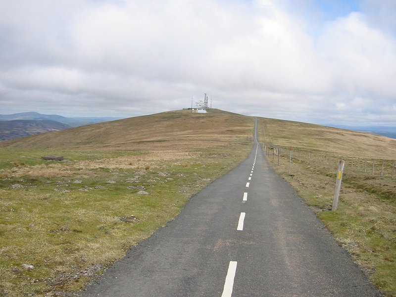
The Cairngorm Mountains in winter, particularly, can offer an environment to match much that is on offer in the more well-known 'wild' places of the world. The Cairngorm range consists of three plateaux, separated by deep glens that were gouged out by glaciers during the last ice age. The amount of land in this plateau area that is above 1000 metres is larger than any other location in Britain, and it is often described as a sub-arctic environment. The landscape is relatively flat and featureless, and when snow-covered can represent the ultimate challenge for a walker. Add a blizzard or nightfall, and even the ability to use a map and compass is sometimes not enough. Many walkers have died in the Cairngorms in even relatively benign conditions.
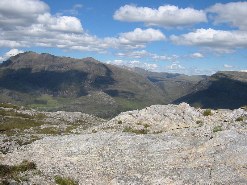
So what on earth is the attraction of the wilderness when there are these sorts of dangers? There are probably as many reasons as there are walkers. Beautiful scenery is certainly an attraction, but there are many parts of Scotland where amazing sights can be seen from the comfort of a car, like Glencoe or Skye. The walker who ventures into a part of the Scottish landscape that is many days walk from the nearest contact with other people is doing something a bit different from even those walkers who are climbing a hill on a day trip. They're putting themselves out on a limb, and this may be part of the reason why people are drawn to do it. It's a physical and mental challenge, a chance to pit one's wits against nature in a way that life in a city doesn't offer to modern people in the western world. This can be particularly so if an expedition of this nature is undertaken alone, with all the dangers that that entails. The experience of being alone in a vast landscape that offers no human comforts and of being able to prepare for, endure and ultimately enjoy it can be a profound one. Whilst I don't believe the experience in any way approaches the spiritual or even the mystical (there are too many discomforts for that!), it is certainly something that can teach you about yourself, your limits, and what is possible. There are also some sights in Scotland that can only be seen by walking for a long distance into the wilderness. The falls of Glomach, the Corrieyairack and Minigaig passes, Cape Wrath, Loch A'an in the Cairngorms, the peaks of the Knoydart peninsula and Loch Coruisk on Skye are just some examples. If you haven't got a helicopter, and want to see some of the best parts of Scotland and perhaps get some good photographs, you have to be prepared to put a tent on your back and yomp for mile after mile.
To undertake such a trip into a wild and uninhabited area requires competence in navigation above all else. A fit person could survive for a few days without food, and water is often available in rivers in the Scottish mountains. A walker could even be lucky with the weather and not require waterproof or insulated clothing. However, if a walker were to venture into one of these areas without a map and compass, then the chances of the trip being a pleasant experience are minimal. Even more important than having these is the ability to use them well, i.e. to be able to navigate. It's often said by many wilderness experts that the best piece of equipment you can carry with you when entering a wilderness area is your brain.
Knowing where you are in this sort of landscape is an essential skill. It is all too easy to descend from a summit down the wrong ridge and at best, be faced with a long walk back to your starting point. Walking above the cloud base is very common in the Scottish mountains, so navigating by relating the locally visible topography of the land to the map features, and estimating distances walked on a compass bearing becomes necessary to avoid getting lost. Finding an exact location on a flat plateau such as the mountain summits that are to be found in the Cairngorms and the White Mounth area near Braemar can become an almost impossible task. This becomes important to walkers (such as Munro-baggers) whose main aim is the attainment of the exact location of a particular mountain summit. Munro-bagging is an activity that probably has more in common with train spotting than hillwalking. The proponents are often the same, being young men with too much time on their hands, and the process can, at its worst, degenerate into a grim list-ticking activity. The objective is to climb all the 284 summits in the Scottish Highlands higher than 3000 feet, but to achieve this many devotees would say that you actually have to stand on the highest point of the mountain. Arguments rage about what this actually means and what actually constitutes a distinct summit or indeed a mountain. The obsessive mountain pedant's source of information for debate on this topic are the archives of 'The Angry Corrie', a hillwaking fanzine that has given me many hours of guilty reading pleasure. The question becomes, how close to the actual highest point does one have to be to claim that a particular summit is 'bagged'? This can be a difficulty on certain mountains that have multiple peaks of similar height along a ridge or where the highest point is an indistinct area of a much larger flat plateau. When the cloud base is low or all features of the landscape are blanketed in a homogenous layer of deep snow, finding summit locations in these sorts of conditions can be next to impossible. Many times I have walked to what I thought was the highest point of a mountain only to realise afterwards upon reading a description of the route in a book and scrutinising a map carefully that I had instead reached a lower summit nearby, oblivious to the actual summit hidden in mist or clouds a few hundreds of metres away. This happened to me on Beinn Dorain, a Munro summit that can be seen rising spectacularly from the road to Glencoe north of Crianlarich. The question of whether or not an actual summit has been attained can be a bit academic - if you only walk to within a metre of the summit, have you reached the highest point? My own opinion is that to worry about that sort of distance would be ridiculous, but in the case of Beinn Dorain I calculated that I had missed it by about 500 metres so I decided that I had not reached the highest point, and I had to go back on a day when the weather was better and do it again. Clearly my own personal 'feeling' for the accuracy of attaining a summit lies somewhere in between these two distances.
Another problem that faces hillwalkers who are fixated on successfully attaining summits is hills with multiple summits of the same height; is it necessary to stand on all of these summits? At first glance this seems to be a ridiculous problem; how can a hill have two summits? Surely one summit is higher than the other, even if it is just by a few centimetres? However, maps showing the heights of hills, regardless of how they are surveyed, are only accurate to within certain limits, and in the case of UK maps (the most widely-used and authoritative coming from the national mapping agency, the Ordnance Survey) these limits are larger than centimetres and hence summit heights shown in metres can frequently coincide exactly on a map if they are quite similar in height. These summits can be hundreds of metres apart and impossible to differentiate in height even when gauging them by eye on location. Mountains with multiple summits do exist in Scotland; I have climbed two of these, Carn Dearg near Ben Alder and Slioch in Letterewe. These mountains, both of which are Munros, have two distinct summits that are equal in height, although there is very little drop in height between them. In both cases, guide books mention the multiple summits and specify one as the 'true' summit with no real justification. My own view is that a hillwalker should attempt to get to all the summits, as this will give them a true experience of the hill, but that only one summit is necessary to enable the hillwaker to say they have successfully climbed to the 'top' of the hill.
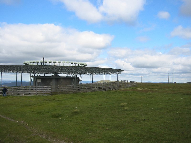
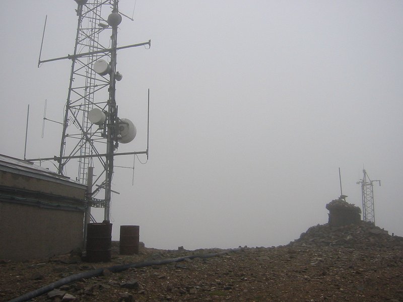
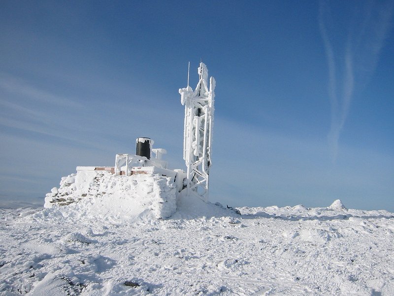
Yet another related issue when it comes to deciding if one has actually attained the summit of a mountain, is your physical location (i.e. where you are standing) on the summit. This sounds like an odd thing to consider until you actually think about what is actually on a summit: typically on a Scottish mountain there is a cairn, or pile of stones built up by successive walkers over the years. Is it necessary to climb to the top of the cairn? Is touching the top of this cairn with some part of your body enough? These questions become even more difficult to answer when there are man-made structures on the summit, such as the huge air traffic control buildings on Broad Law and Green Lowther in the Scottish Southern Upland hills, or the radio masts on the summit of the munro The Cairnwell. Climbing to the tops of these structures would be an apparently foolish thing to do, but can you truly say you have attained the highest point on a mountain if you have not done so?
One point of view about this is the suggestion that objects which are alien to the mountain in its natural state (i.e. before people came along) shouldn't be considered a part of the mountain - but what about the assorted huts and shelters on the summit plateau of Ben Nevis and the weather station on the summit of Cairn Gorm? These use large boulders from the mountain as significant parts of their structures. My own view is that worrying about this sort of thing is not necessary to enjoy the sense of achievement that comes with climbing a mountain - life really is too short!
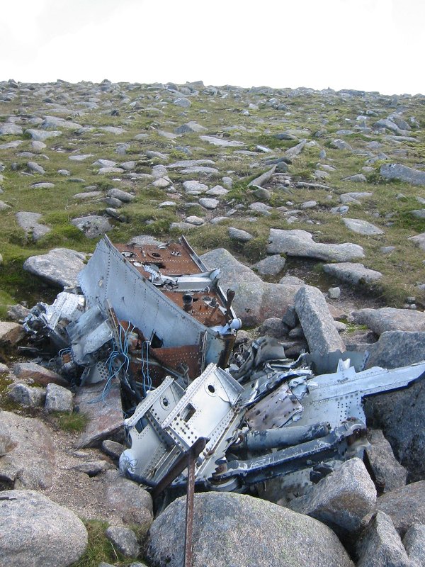
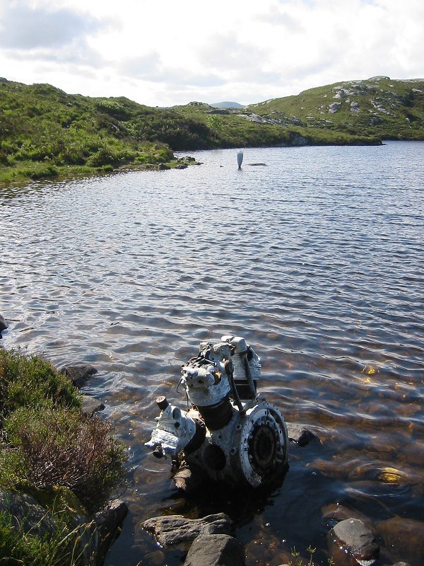
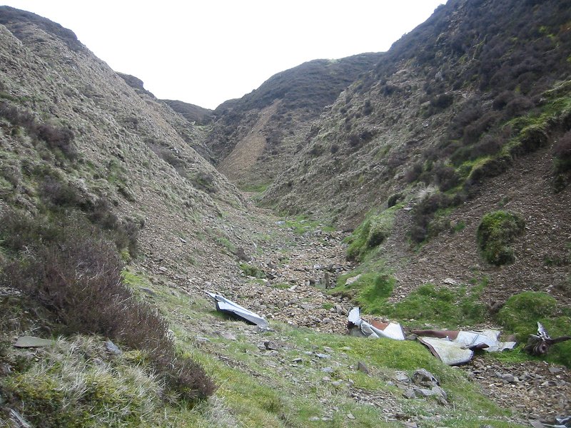
However (and there's always a however)...there are some summits in Scotland that keep me awake at night. The most astonishing example of this is perhaps Sgurr Dearg, in the Black Cuillin range on the island of Skye. The summit of Sgurr Dearg looks like a summit should look like, and also feels 'naturally' like the highest point in the local area. It isn't though - a blade of rock, which doesn't even protrude from the summit but from a ridge several metres below, just overtops the 'natural' summit by a few metres. This rock, colourfully called the 'Inaccessible Pinnacle', requires (unlike Sgurr Dearg, and every other Munro summit in Scotland) ropes and rock-climbing techniques to get to the top. Although I have climbed to the top of Sgurr Dearg, I have not climbed to the top of the Inaccessible Pinnacle, so in my own mind (and I believe almost any other hillwalker or mountaineer would agree) I feel that this is one mountain that I have definitely not reached the summit of. The summit of Ben Avon in the Cairngorm mountains is a similar case, although not perhaps such a dramatic one. The extensive flat summit plateau is actually crowned by a large 'tor', an unusual granite rock formation of which there are several scattered throughout the Cairngorms. Although not usually described as requiring ropes or rock-climbing techniques to get to the top of, it's still a scramble that requires some nerve to climb up. When I walked up Ben Avon, I decided that the risk of trying to get to the top outweighed any feeling I had that I needed to to actually attain the summit of the mountain. It seemed to me when I was there that this lump of granite was just like a cairn, which didn't really represent the mountain as such. Clearly, just like distances from a summit, I have my own personal feeling for where you actually have to stand to attain the summit of a mountain, although the case of Ben Avon is one that I'm still not really certain about. Sometimes getting to the top of a mountain can be difficult for other more prosaic reasons. A mountain which took me three attempts to attain the summit of is Creag Megaidh, near Glen Spean. On my first attempt I walked up past the famous rock climbing cliffs of Coire Ardair and into the 'Window', a narrow col just below the extensive summit plateau. I made it to within about 500 metres of the summit cairn, crawling on my belly in hurricane force winds before giving up. My second attempt took me along a high ridge to the east of the main summit plateau with many subsidiary tops and cols. The cloud base was below the level of the ridge so I was walking in cloud and my estimations of how far along the ridge I had gone became less and less accurate. In these sorts of conditions it is easy to overestimate the distance travelled, and also to subconsciously take the route that looks easiest, which is often the one that goes downhill. I ended up emerging from the clouds onto a ridge heading in the wrong direction many kilometres away from the main route to the summit. Although I wasn't in any danger, limited supplies of daylight and fitness reserves meant giving up the walk to the summit and retracing my steps back to my starting point. On a third attempt in November, I made it to the summit plateau but in the whiteout conditions finding the summit cairn on the large flat plateau was very difficult. After wandering around in circles for ten minutes, the cairn popped into view in a break in the swirling snow, and I finally 'bagged' the summit, more by luck than design. Going round in circles on a featureless landscape in a whiteout is asking for trouble, and you have to really ask yourself if finding the exact location of the highest point on a mountain is really worth the risk in severe conditions. If I had had a GPS receiver with me on these trips, then I would have been able to navigate to the summit much more effectively (major summits can be added to the GPS as 'waypoints' well before venturing out), and saved myself the need to make decisions that are affected more by blind macho ambition than common sense (or indeed the wish to just have a pleasant day walking in the hills!) Using a GPS also enables one to retrace the route already walked - a useful aid when you walk into a whiteout and realise that you'd really rather be at home in bed. The modern walker with some disposable income has options open to them now that walkers of even ten years ago did not have. A GPS receiver can be a vital walking aid. Although they do not replace the traditional tools of navigation such as a map and compass, they can be used to complement these and help to reduce the risk of getting lost. For many years I have walked all over Scotland without such a piece of equipment, and I resisted buying one because I thought it an unnecessary expense [see another of my articles about this]. Certainly, GPS receivers have disadvantages; they require batteries to work, so spares must be carried to ensure you can rely on it, it's an extra piece of equipment to carry and worry about losing or breaking, and they can offer an illusion of safety to those who don't take a map or compass with them into the mountains (news reports about rescues often mention that the walkers were not equipped with these). In some ways there is a parallel debate amongst hillwalkers about the utility of carrying mobile phones into the mountains. Many walkers have been rescued quickly because they were able to contact emergency services even though they had little idea of their location. However, in many parts of the Scottish mountains (especially the high-sided glens) there is no mobile phone signal, and relying on one to get you out of trouble could be a very hit-and-miss affair, apart from which, one of the aims of walking in the mountains is surely to escape modern life and experience nature without the effects of man. A mobile phone is a mental connection back to civilization and it can be an extremely unwelcome intrusion to those trying to have a 'wilderness experience'. There's nothing more bewildering and surreal than sitting on a summit soaking up an astounding panorama of mountains and glens stretching for many miles, whilst a fellow walker chats to their friends over the phone about the football scores. Having said that, a walker venturing into the mountains should probably not be without a mobile phone. Their usefulness in certain situations cannot be ignored. However, etiquette demands that the phone be turned off and stored away and used for emergencies only. This is practical too - phones are of no use if the batteries have run down or they fall out of a pocket when fording a stream. The latest 'smart' phones can be even more useful - with a good signal, some phones will allow a connection to the Internet and the possibility of viewing the latest weather maps and reports. Of course there have always been low-tech methods of doing this as well, like carrying a small radio and listening to the forecast, but you can't beat a good map! As live weather maps might complement the traditional tools of mountaineering and hillwalking, so too with GPS maps. The ability to know your current coordinates using a GPS receiver and then to relate this to a traditional paper map is a powerful advantage to navigation, but now some modern handheld GPS receivers go further than this and have the ability to display colour maps on a display screen to show the current location and route graphically. The detail available with these GPS maps is now approaching that of the Ordnance Survey Landranger 1:50,000 scale mapping. A few years ago, GPS signals (which originate from US-operated satellites) were intentionally filtered so that there was a considerable error in the location reading, of the order of tens of metres. In practical hillwalking terms, this can mean the difference between an exhilarating walk along a mountain ridge, or plunging over the edge. In 2000 this filtering was removed so that now positional accuracies of the order of 5 metres are attainable, and make navigation in the Scottish mountains using GPS safe and indeed can enhance the experience in many ways. The ability to store locations in a GPS receiver as waypoints has other advantages apart from helping with the dubious pastime of munro-bagging. On many of my walks in Scotland I have come across twisted lumps of metal clearly recognisable as aircraft parts, often very high up and sometimes right on the summit of mountains. Being intrigued by this, I purchased a copy of 'High Ground Wrecks and Relics', a small book which lists details of aircraft (usually military) crash sites in the mountainous areas of the UK that still have wreckage lying around. There are a surprising number of these, most dating from the period of the Second World War and directly after. Using the book I was able to identify some of the wreckage I had seen, and because the book contained Ordnance Survey grid references to wreckage sites, I was able to visit some startling sites on subsequent walks, perhaps most notably the remains of a crashed Canberra Jet on the summit of the munro Carn an t-Sagairt Mor near Braemar [see another of my articles about this]. Not all of the sites are easy to find though, and often the remains are in several different locations. A single six-figure grid reference, of the sort given in the 'High Ground Wrecks and Relics' book refers to a square measuring 100 metres on a side, so finding an exact crash site location on a mountain using this grid reference with a map can be a difficult task, particularly if the landscape has small ravines or boulder fields that wreckage may have fallen into. This is where using GPS waypoints will help and I hope in the future to visit some of the crash locations in Scotland and collect more accurate positional data using a GPS receiver.
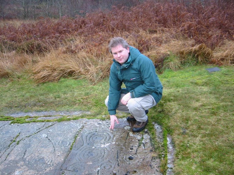
Another type of interesting feature that a walker might see on walks in the countryside of Britain (although not actually high up in the mountains) is an ancient megalithic structure. These are often large stones that can be standing alone or arranged in rough circles and marked with 'cup and rings' of uncertain origin. Although these sites are very numerous throughout Scotland, finding them amongst dense woods or modern human development can be very difficult. Julian Cope's 'The Modern Antiquarian' is the best book for learning about and locating these fascinating sites, and this book also contains Ordnance Survey grid references. Again, the use of a GPS receiver to assist in finding some of these sites is a major advantage. To find out more about Scotland's mountains, I can recommend this excellent book:  'Hostile Habitats - Scotland's Mountain Environment: A Hillwalkers' Guide to Wildlife and the Landscape' |