RAF Consolidated Catalina, Vatersay, Western Isles, crash date 12/05/44

[Picture from wikipedia.org]OS 10-figure grid refs (GPS):
NL 64151 95777
NL 64157 95745
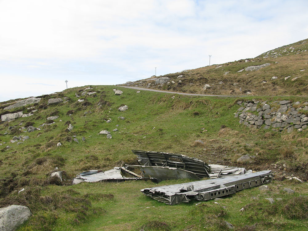
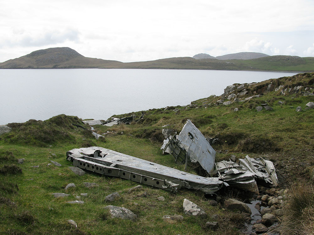
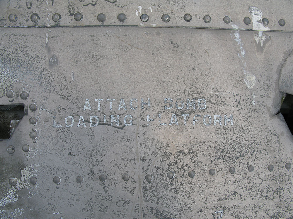
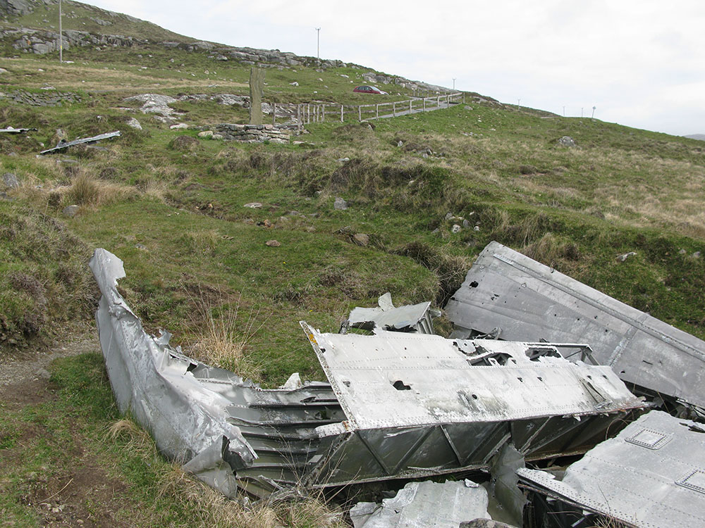
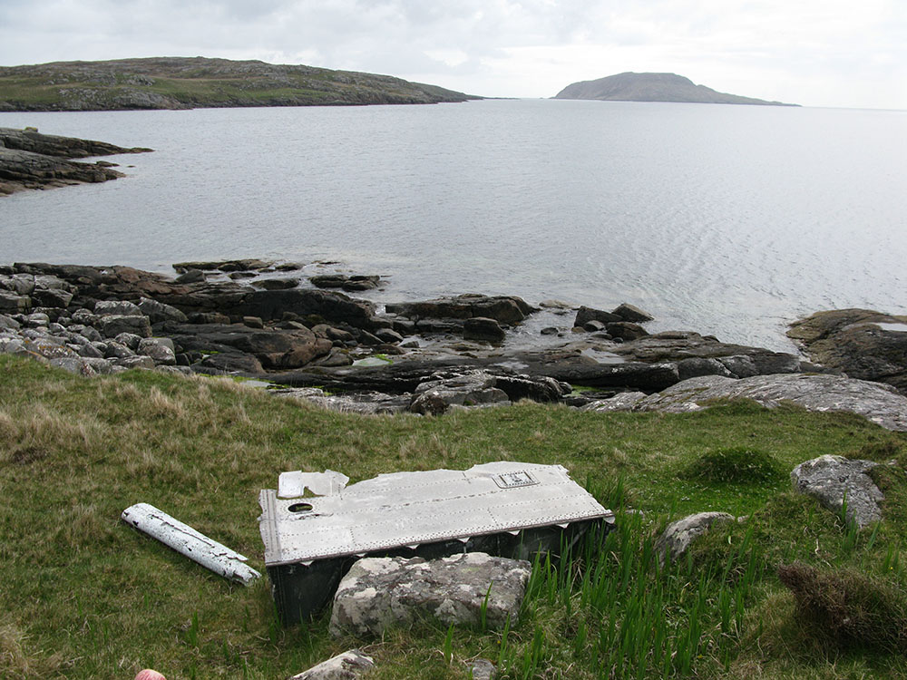
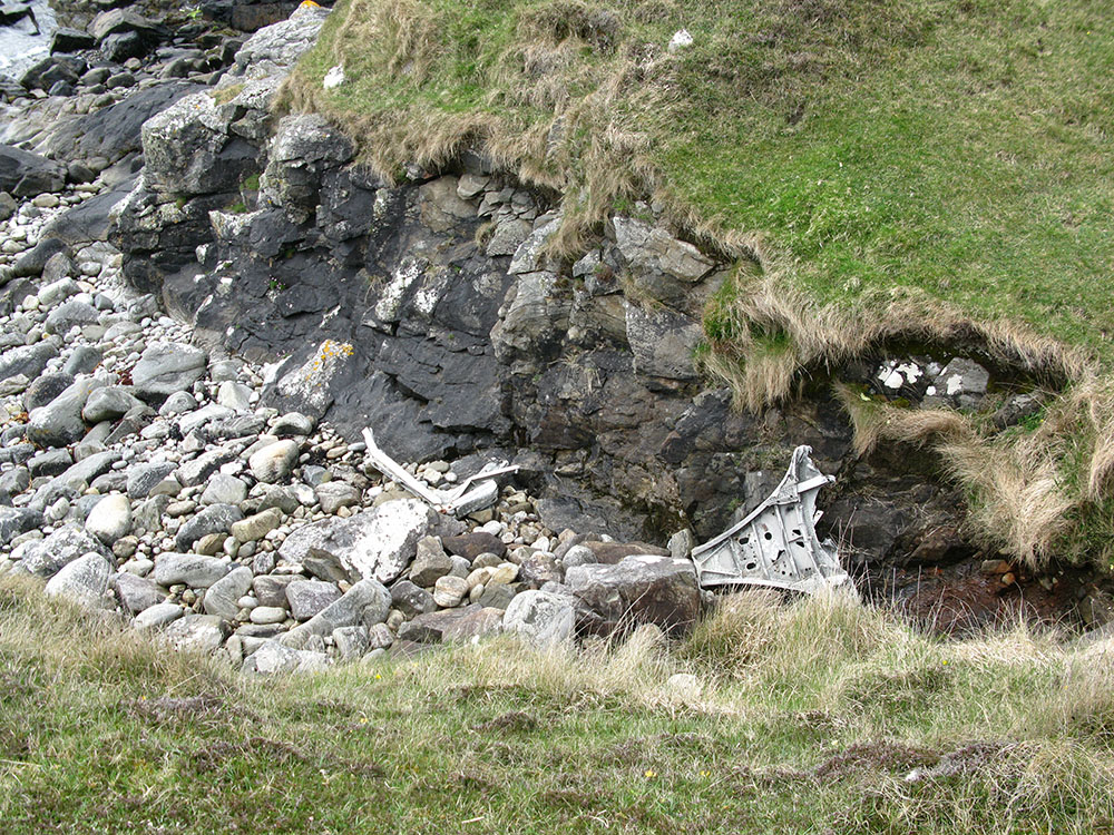
NL 64217 95782Google Maps display showing wreckage locations This wreck site is possibly unique amongst aircraft wreck sites in Scotland (certainly in the sites I have visited) in lying at sea level on the island of Vatersay in the Western Isles, and in being right next to a public road. Some large pieces of wreckage remain, including large sections of the fuselage structure and wings.
Undoubtedly the remote location of this site at the very southern tip of the Western Isles accessible only by ferry or flight from the UK mainland has contributed to the lack of interference with the wreckage parts, despite being so near to a road, and so well-publicised (it features in a lot of the tourist publications for the islands of Barra & Vatersay).
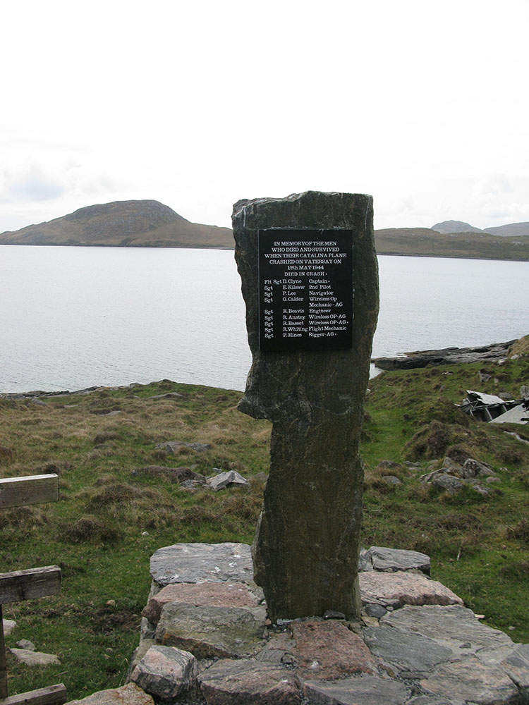
The Catalina crashed into the 172m high hill of Heiseabhal Beag on Vatersay, and all of the wreckage has subsequently ended up lying at the bottom of the hill on its eastern flank, between the public road that runs through Vatersay and the shoreline of Vatersay Bay. Remarkably 6 crew survived the crash. There is also a memorial to the victims of the crash at the site.
There is some information about the crash on the ACSS website here. These websites also have some information about the crash and photos of the site:
http://www.isleofvatersay.com/Vatersay2bhist.html
http://www.isleofbarra.com/for-visitors/vatersay/the-catalina.html
http://www.rootshebrides.com/datastore/discussion/phorum/read.php?3,3118,3120These pictures were taken in May 2010.
 |
 |
 |
 |
 |
 |
 |