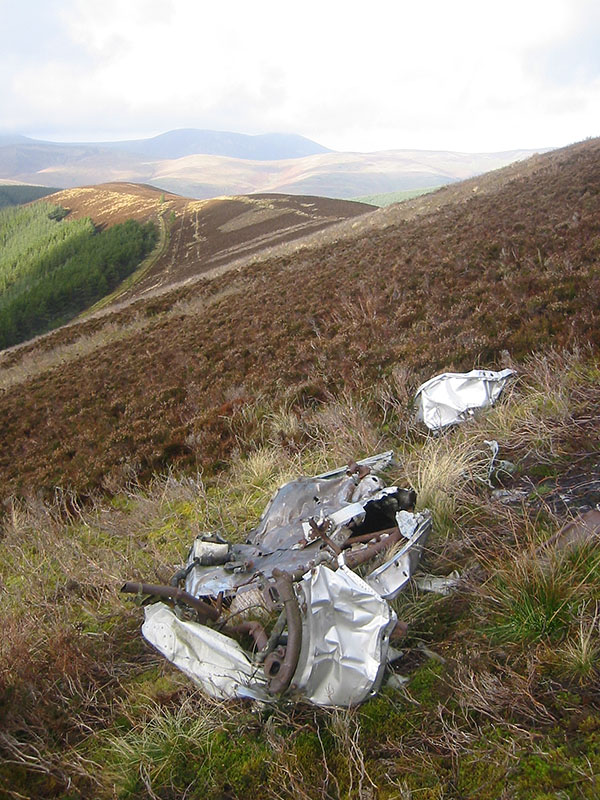
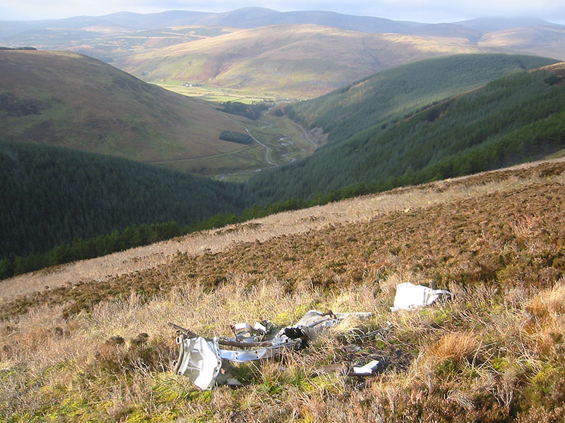
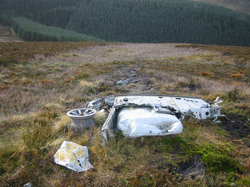
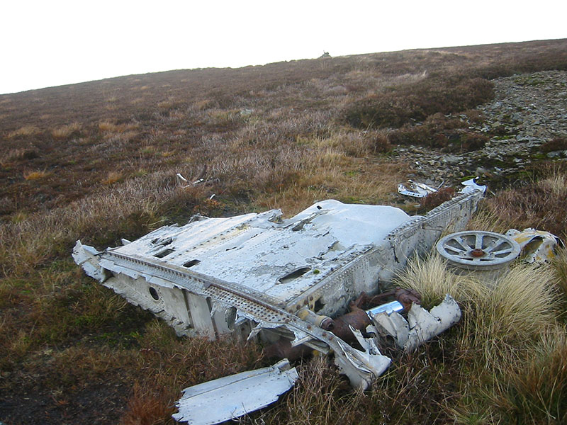
RAF North American Harvard Mk.IIB, Broad Law, crash date 16/01/53
[Picture from wikipedia.org]OS 10-figure grid refs (GPS):
NT 13233 26018
NT 13276 26049
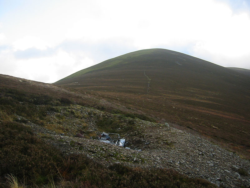
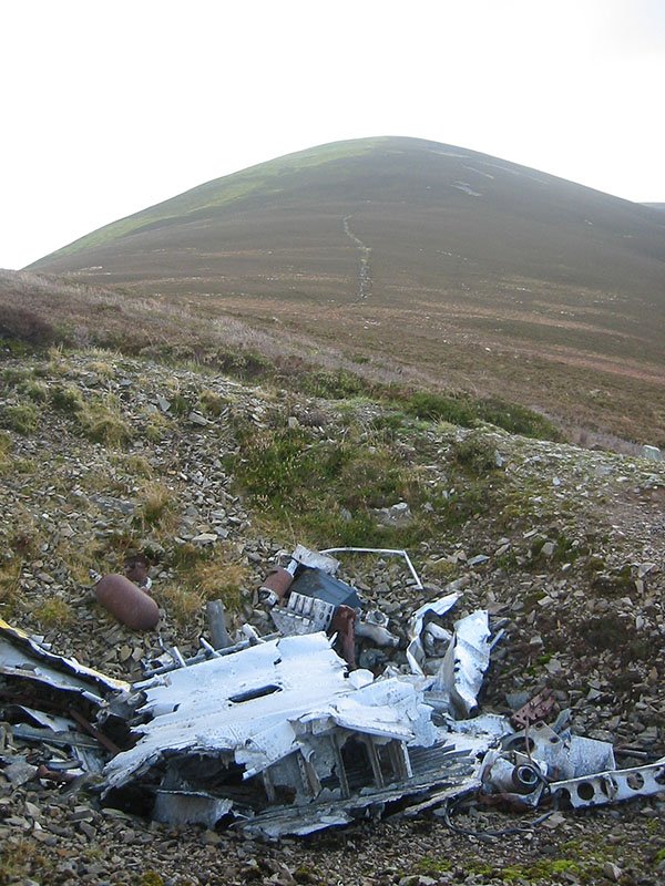
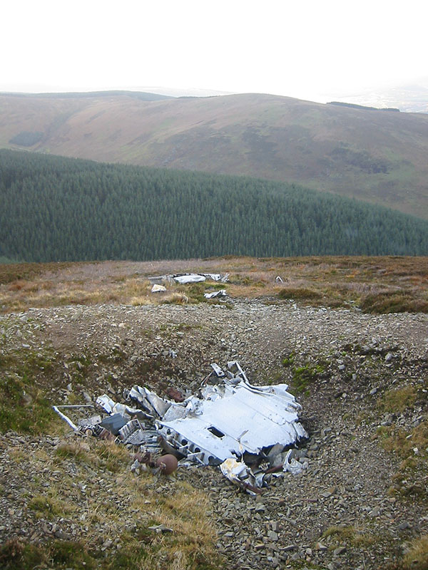
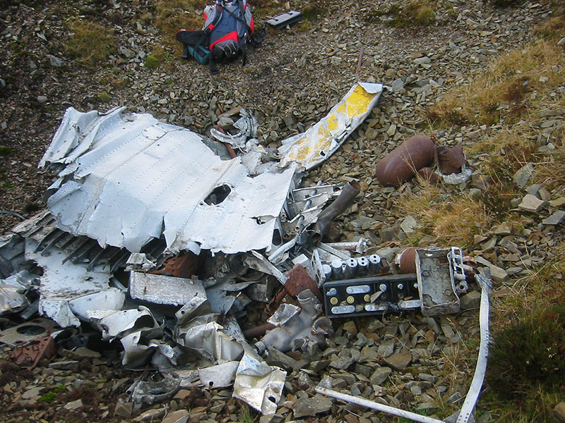
NT 13295 26062Google Maps display showing wreckage locations This site lies at an altitude of about 550m, 2½ km north-west of the summit of Broad Law, very close to the minor summit of Little Knock. There is a crater at the site filled with wreckage testifying to the severity of the crash, and scattered wreckage further down the hill, including a wing with landing gear.
These pictures were taken in November 2008.
There are some pictures of the site on the ACIA website, and some photos and information about the crash on the PDAAR website.

 |
 |
 |
 |
 |
 |
 |
 |