RAF Avro Anson, Ben Macdui, crash date 21/08/42
[Picture from wikipedia.org]OS 10-figure grid refs (GPS):
Allt a'Choire Mhòir:
NN 98365 99350 NN 98422 99348
NN 98484 99332 NN 98597 99199
NN 98567 99305 NN 98609 99131
NN 98636 99289 NN 98610 99090
NN 98818 99279
Snowy Corrie/Garbh Uisge Mòr:
NN 99229 99340 NN 99439 99316
NN 99599 99799 NJ 00038 00031
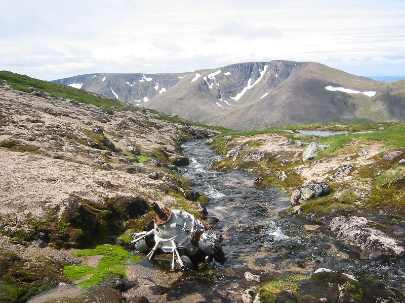
Google Maps display showing wreckage locations This site must be the highest wreck site in the whole of the British Isles. It lies about 300 metres north-west of the 1309m summit of Ben Macdui and the wreckage is located between altitudes of about 1150m and 1250m. More wreckage lies to the east of the summit of Ben Macdui down to an altitude of about 1060m.
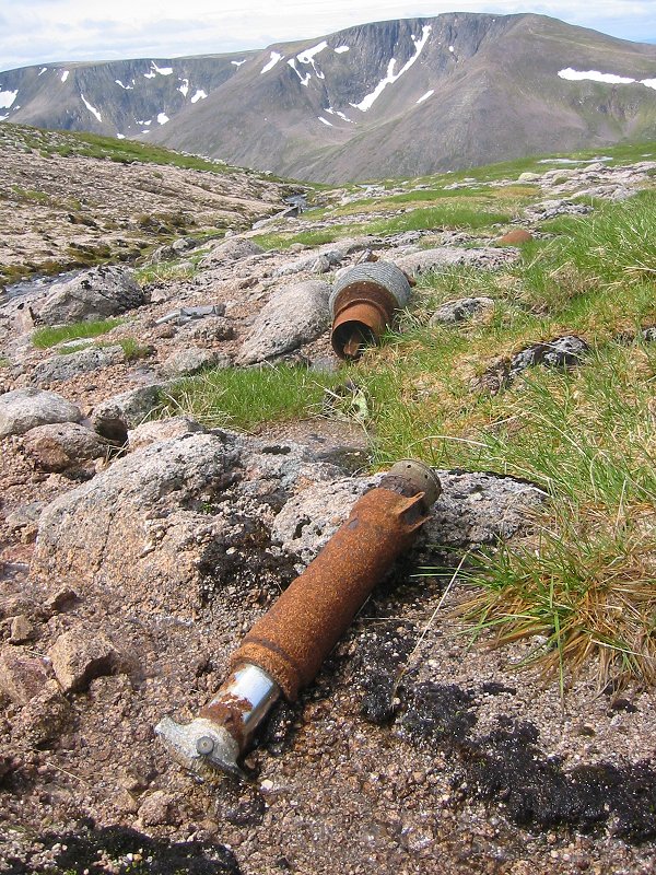
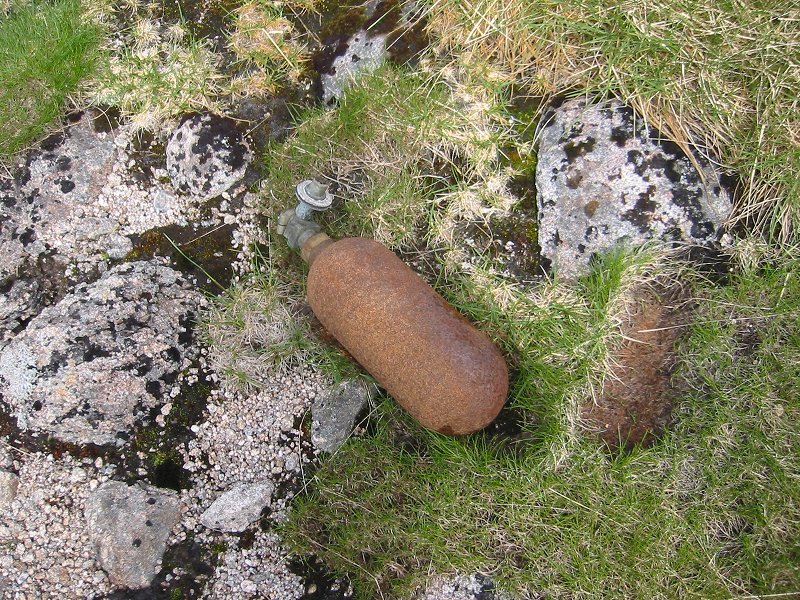
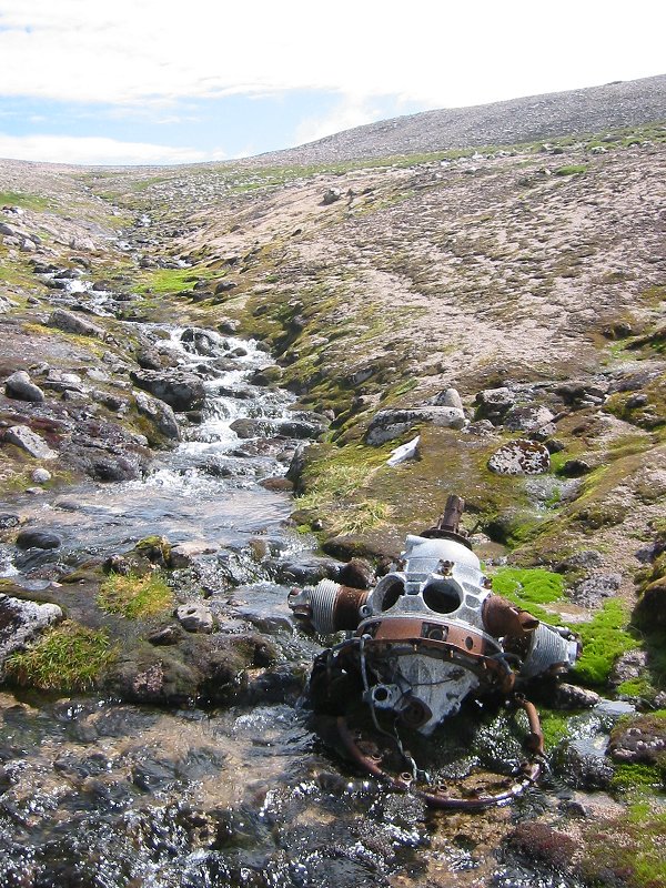
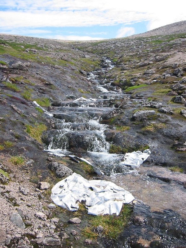
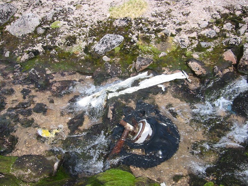
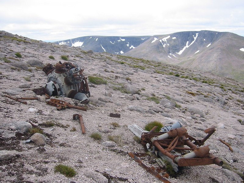
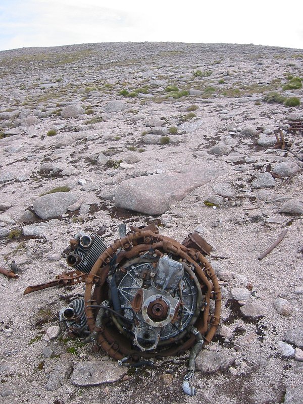
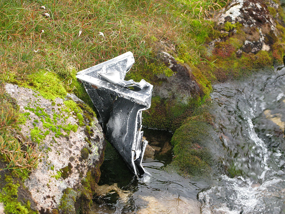
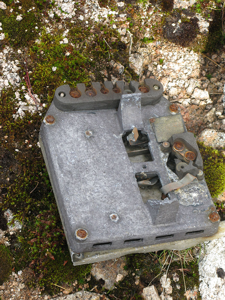
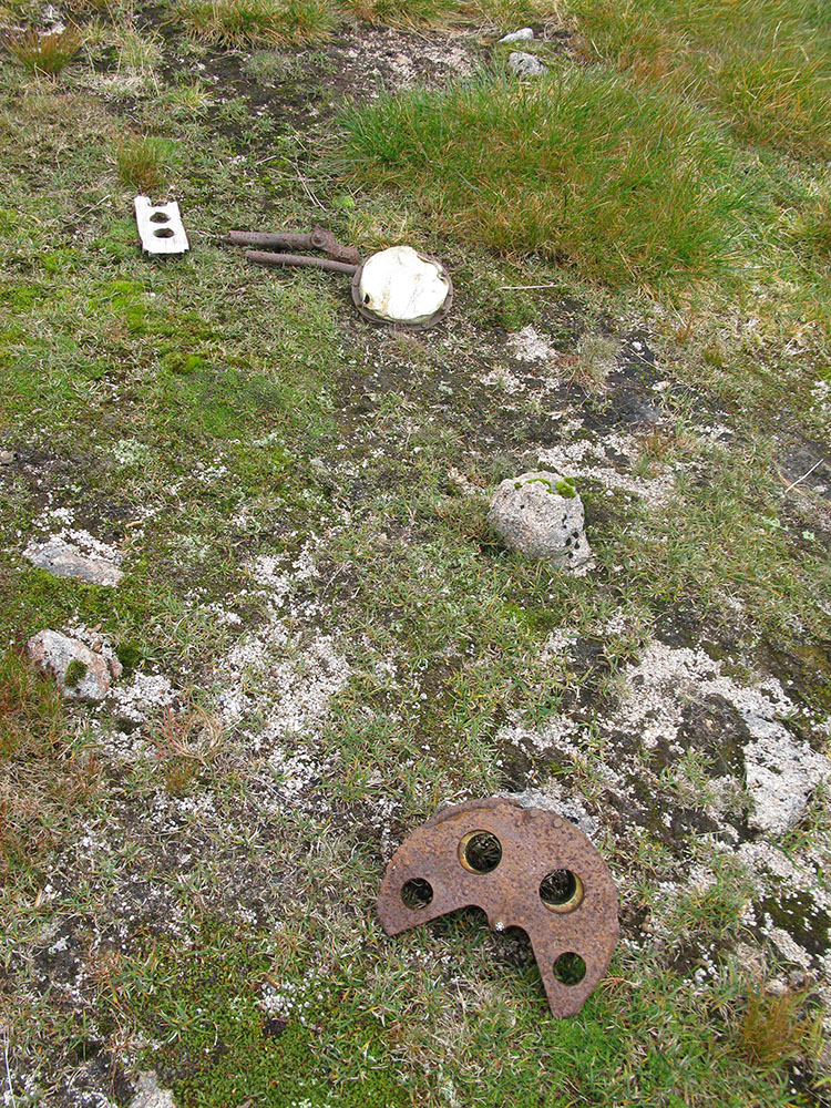
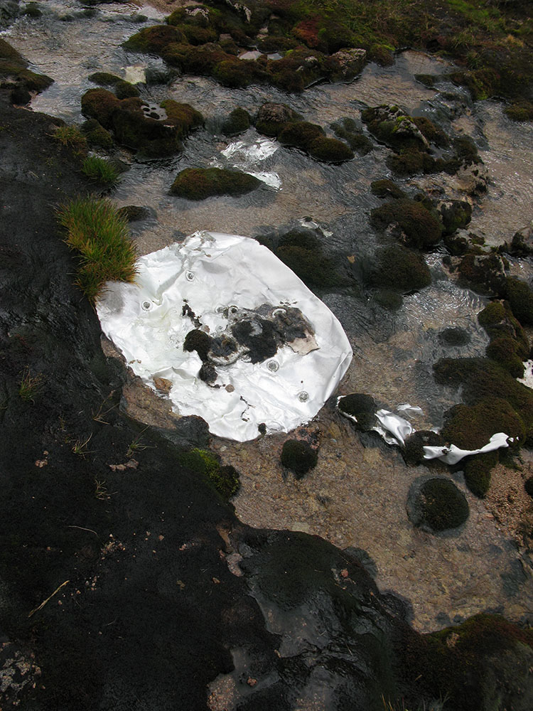
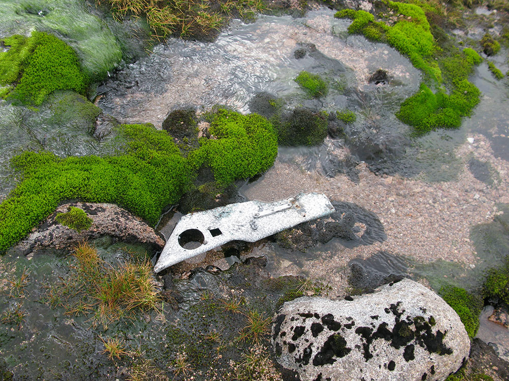
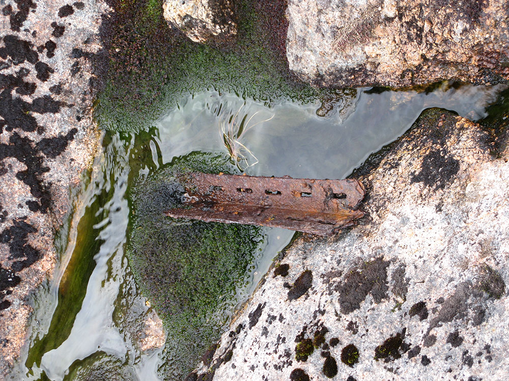
There is a significant amount of wreckage dispersed quite widely. Several pieces of mangled metal, a wheel and one of the Armstrong Siddeley Cheetah engines lie in the water of the Allt a'Choire Mhòir stream, which flows west from near the summit of Ben Macdui. On the north shore of the stream lies a rusted gas bottle and a piston from one of the engines.
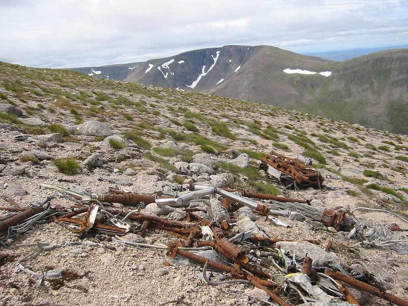
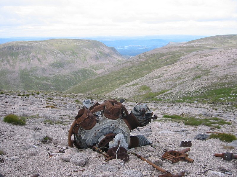
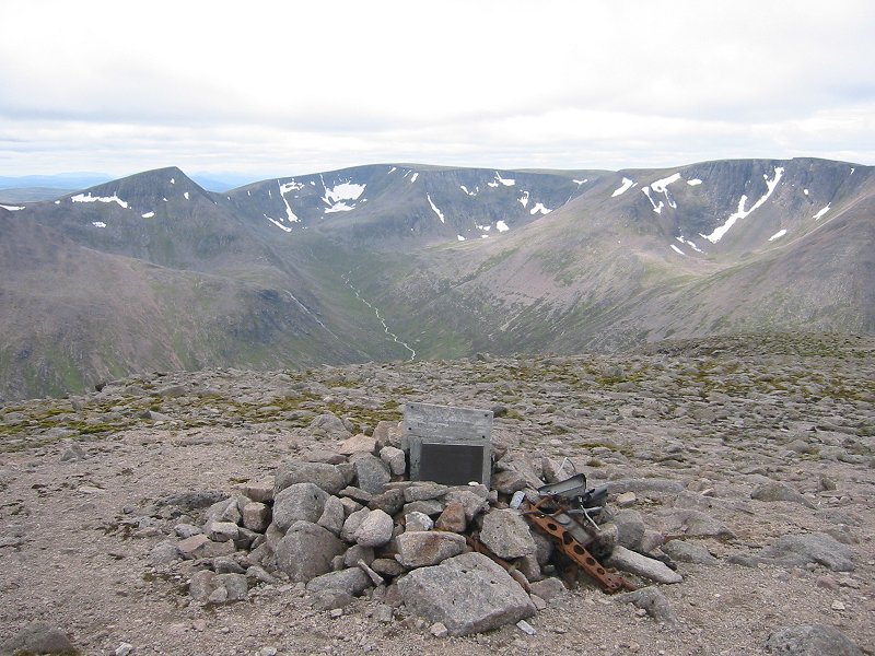
On the south side of the Allt a'Choire Mhòir, further up the slope lie several wreckage fields and the other engine. The highest pieces of wreckage (with an astonishing view towards Braeriach and the crash site of a Bristol Blenheim in Coire Ruadh, see my page about this site here) are next to a small memorial cairn (marked on the OS map) to the airmen who died.
In 'Highlands of Scotland' by Seton Gordon (Hale, 1951) there is a mention of this site (although Seton Gordon is probably confusing the type of plane involved with the Airspeed Oxfords that crashed on Braeriach in 1943 and Beinn a'Bhuird in 1945): "One of our own planes met with disaster on Ben Macdui and its crew were killed. The Oxford was ill-fated, for twenty feet more of altitude would have seen it safely over the hill. It crashed so close to the summit that it actually slipped across the watershed".
In 'Some days from a hill diary, Scotland, Iceland, Norway, 1943-50' by Adam Watson (Paragon Publishing, 2012), Adam Watson mentions seeing the wreckage from this crash and the memorial near the summit of Ben Macdui, in July 1944, less than two years after the crash.
The ACSS website has some information about the crash here. The WYACU website has some photographs of the site and information about the crash here and the PDAAR website also has photographs and information here.
David 'Heavy' Whalley has an entry about the wreck site and the crash on his blog here. There is an article about the crash and wreck site on the Press and Journal website here. There is an article about the site on the BBC website here.
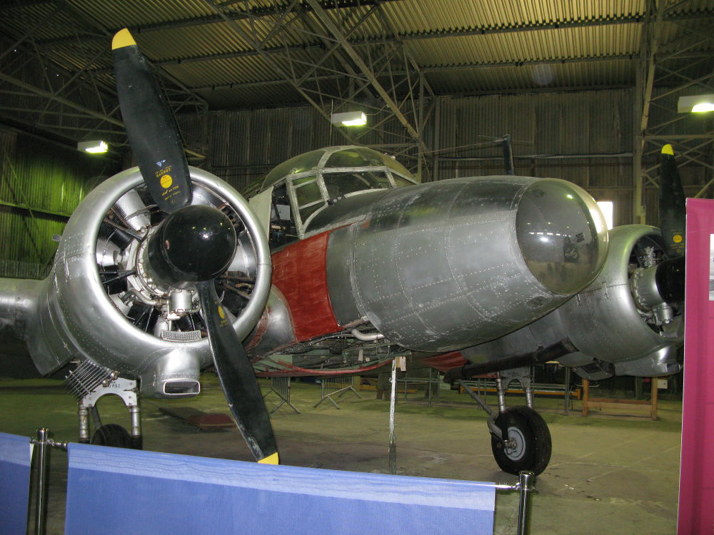
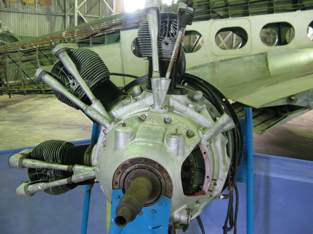
At the National Museum of Flight, East Fortune, there is an Avro Anson and a Cheetah engine on display (two photos below), and this can be used to identify some of the wreckage parts.
These pictures were taken in July 2008.

 |
 |
 |
 |
|
|
|
|
|
|
|
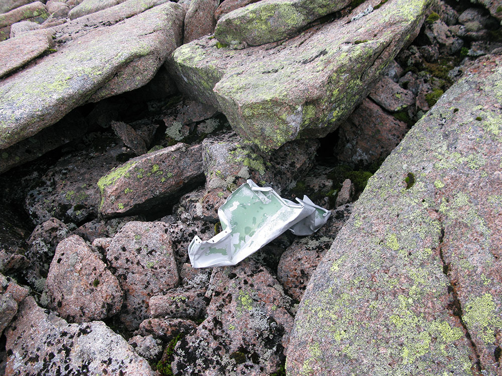
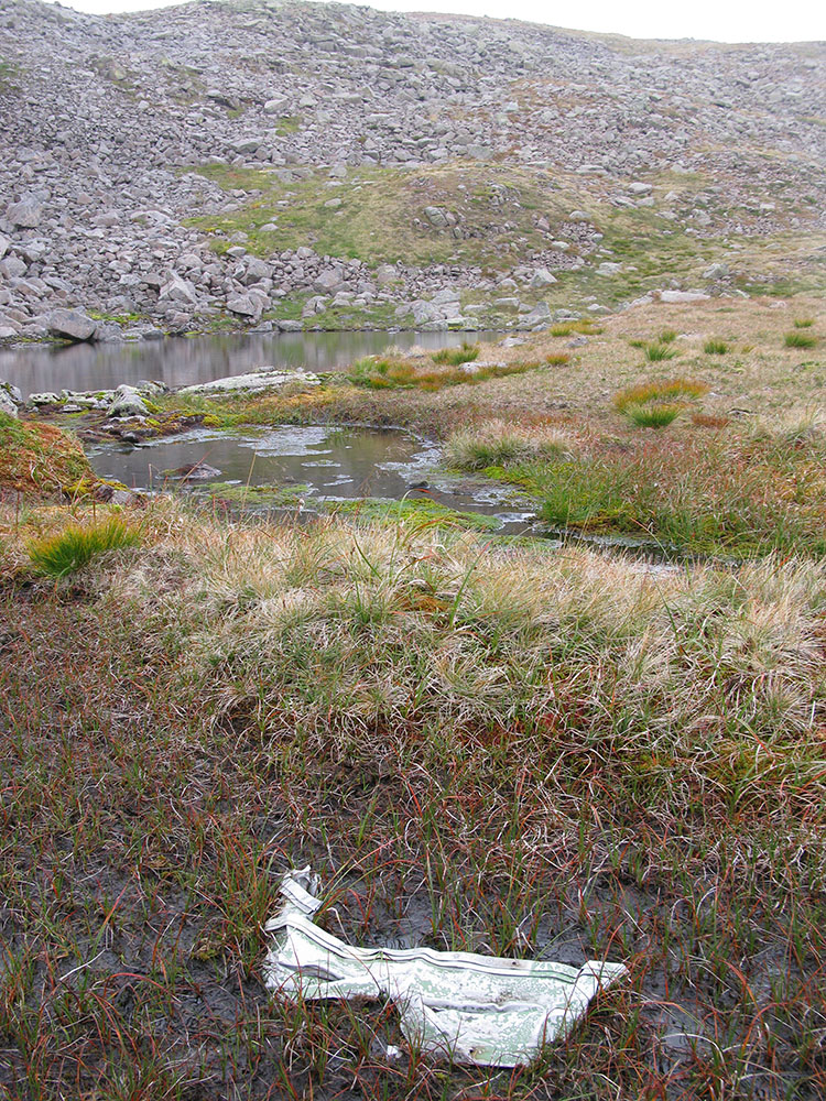
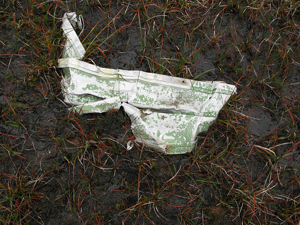
Update August 2009: On a walking trip along the Garbh Uisge Mòr river, east of the summit of Ben Macdui, I discovered a single piece of metal lying amongst boulders. This is almost certainly a piece of aircraft wreckage, but the site is about 1km from the Anson crash site, on the other side of Ben Macdui, so may be from another unknown crash (although this would tie in with the quote from Seton Gordon's book above about the Anson skipping over the watershed). Another possibility is that hurricane-force westerly winds have blown this wreckage from the main Anson debris area.
The TFDACSS website briefly mentions a Spitfire that crashed on Ben Macdui here, and includes a photograph taken in this area.
Location of the site: OS 10-figure grid ref. NN 99599 99799, altitude 1130m, Google Maps.
These pictures were taken in August 2009.
|
|
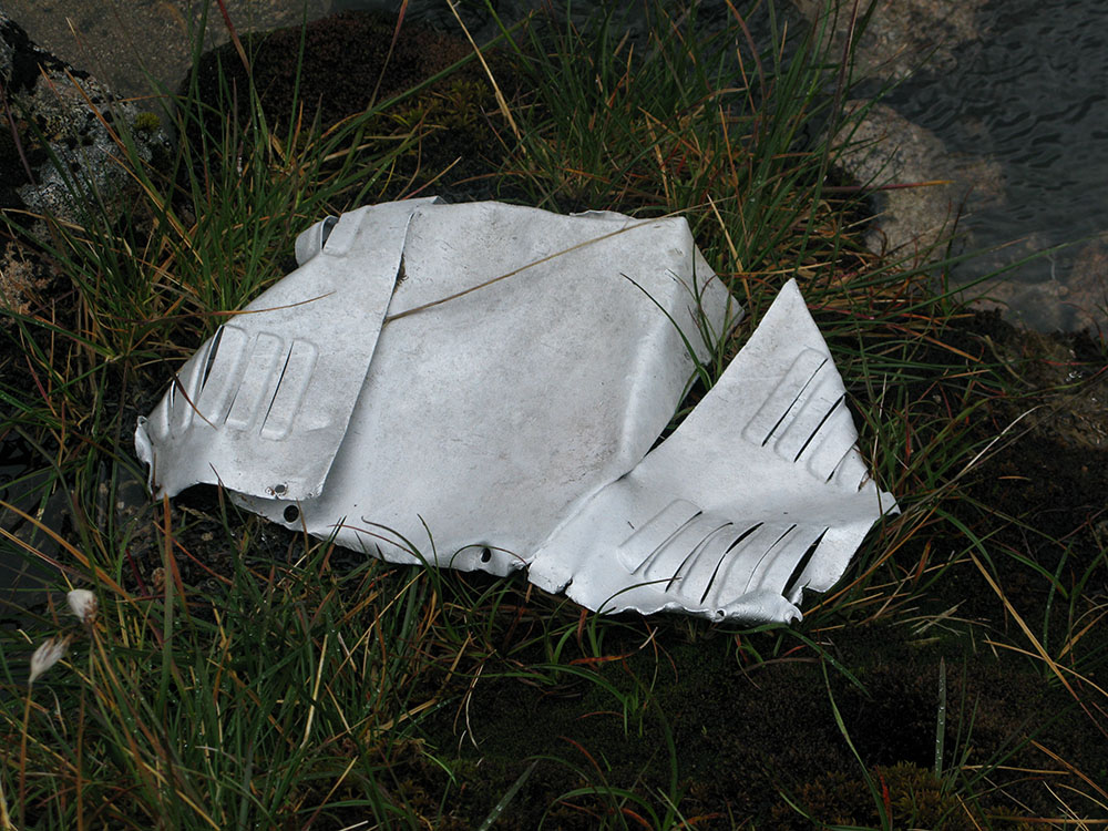
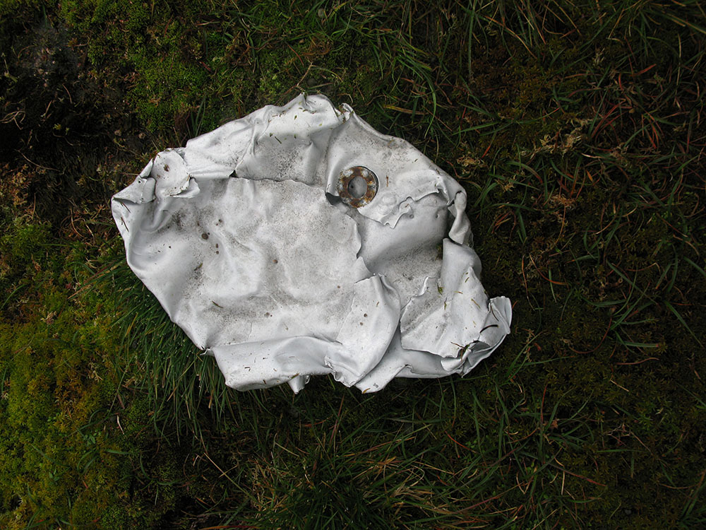
Update August 2010: Whilst on a trip to the summit of Ben Macdui, I explored the corrie directly to the east of the summit plateau known as the 'Snowy Corrie'. At the very top of this corrie, at the headwaters of the Garbh Uisge Mòr river, I saw a few pieces of wood and metal debris. Some of this may have come from man-made structures which once stood on the summit, but at least one piece looks like it may have come from an aircraft, perhaps the Anson (2nd photo from August 2010 below).
There is a very interesting sequence of 6 photographs here, which show the cleanup operation in the area of the Snowy Corrie directly after the crash of two USAF F-15s in the area in March 2001. Although it is obvious that thorough measures were taken to remove all traces of the aircraft it's just possible that some of the debris I saw is from the 2001 crash, lying as it does in well-hidden high-altitude hollows and gullies in the corrie where snow lies until August or even September.
Location of the sites:
OS 10-figure grid ref. NN 99209 99368, altitude 1260m, Google Maps.
OS 10-figure grid ref. NN 99229 99340, altitude 1250m, Google Maps.
OS 10-figure grid ref. NN 99230 99314, altitude 1240m, Google Maps.
These pictures were taken in August 2010.
|
|
|
|
Update December 2011: On a posting on the Winterhighland Scottish Snow & Mountain Sports forum in July 2011, Adam Watson wrote:
"My son was very interested in crashed planes in the hills and I accompanied him on many trips. Although the wartime one on Ben Macdui was NW of the summit, the site is extremely exposed to prevailing gales from the Atlantic and most of the ground is bare gravel without plants. Often from the late 1940s onwards I had seen bits of the wreckage over on the east side of the North Top and down the Snowy Corrie, and when I searched with my son in the late 1970s and early 1980s we found far more. It was obvious that they had been blown across, probably by winter gales and maybe with icy snow affording little friction as well as potentially obstructive boulders being covered by snow. The furthest piece we found was in a small lochan in a hanging corrie above Loch Etchachan, east of the long flat section of Garbh Uisge Mor with its pools, lochans and gravel beds. This was a flat sheet of metal lying on the bed of the lochan in the hanging corrie, and conspicuous from above when the sun was shining. A long way from the crash site at Allt a' Choire Mhoir!"
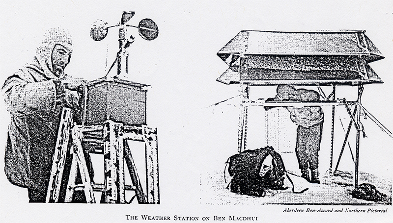
In the Cairngorm Club Journal Vol. 17 (1957), P D Baird writes a report of a weather station near the summit of Ben Macdui that he manned throughout the year of 1956, to monitor meteorological variables and the nearby long-lying snowpatches in the Snowy Corrie (one patch lasted until that winter). Two black and white photographs of the weather station accompany the report (which can be seen here), and the metallic frames used in the construction of the weather station in the photographs look very similar to the two pieces of metal in the 1st and 4th photos from August 2010 above, indicating a possible identification for this debris in the Snowy Corrie.
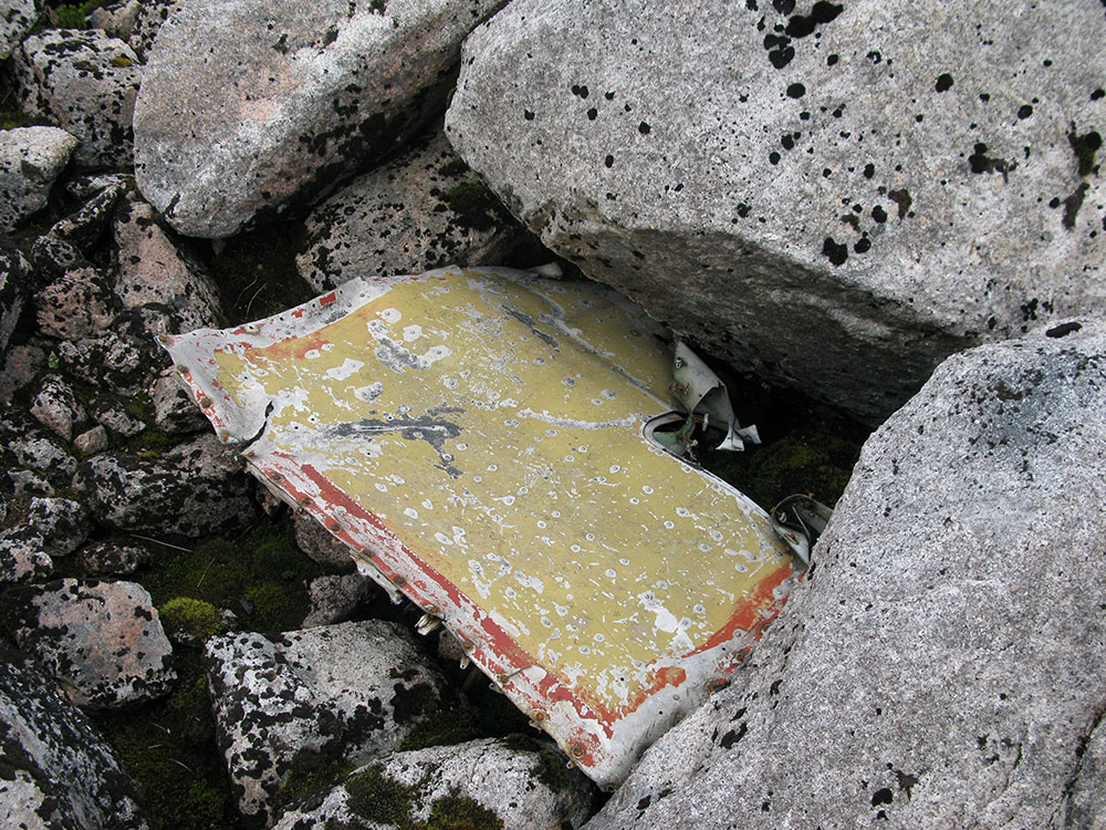
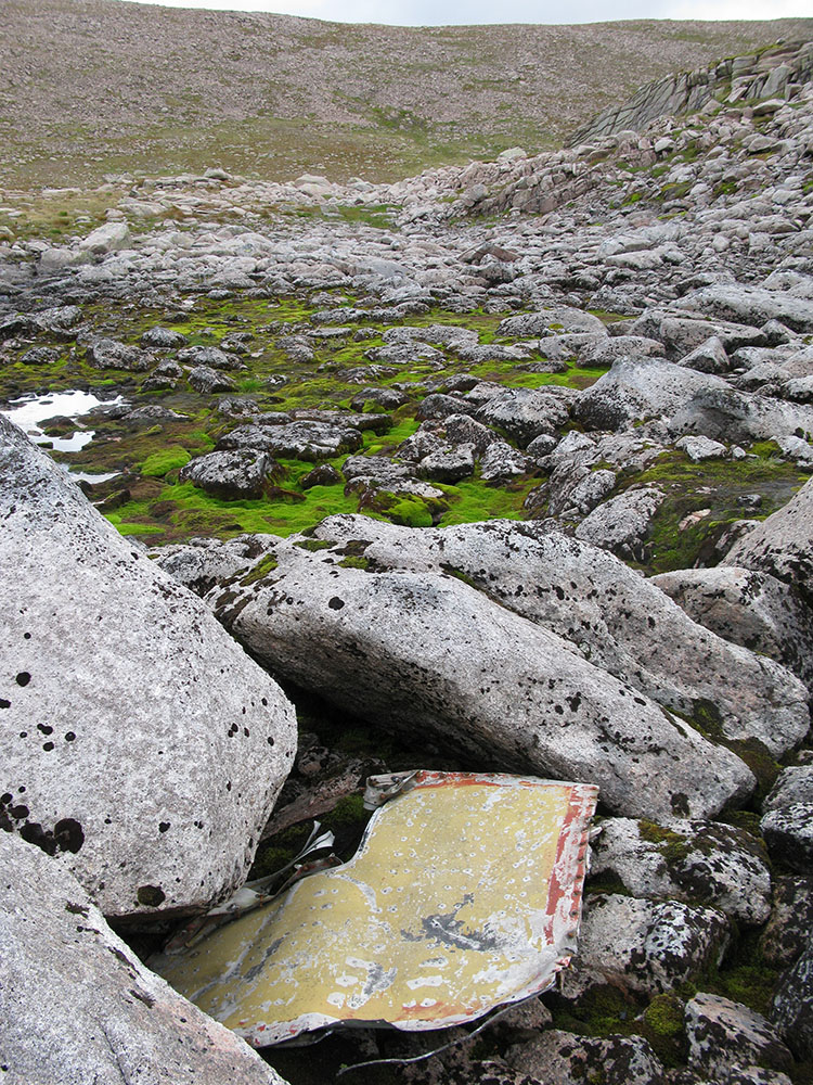
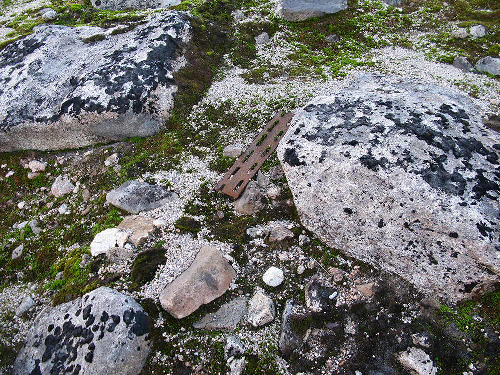
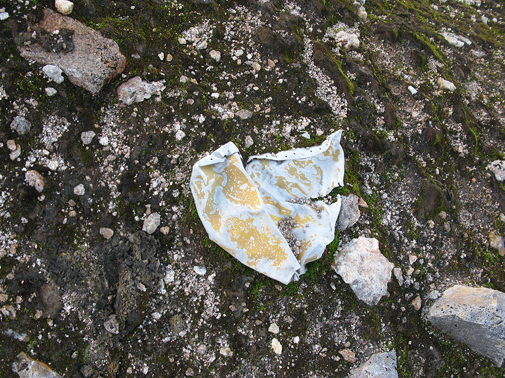
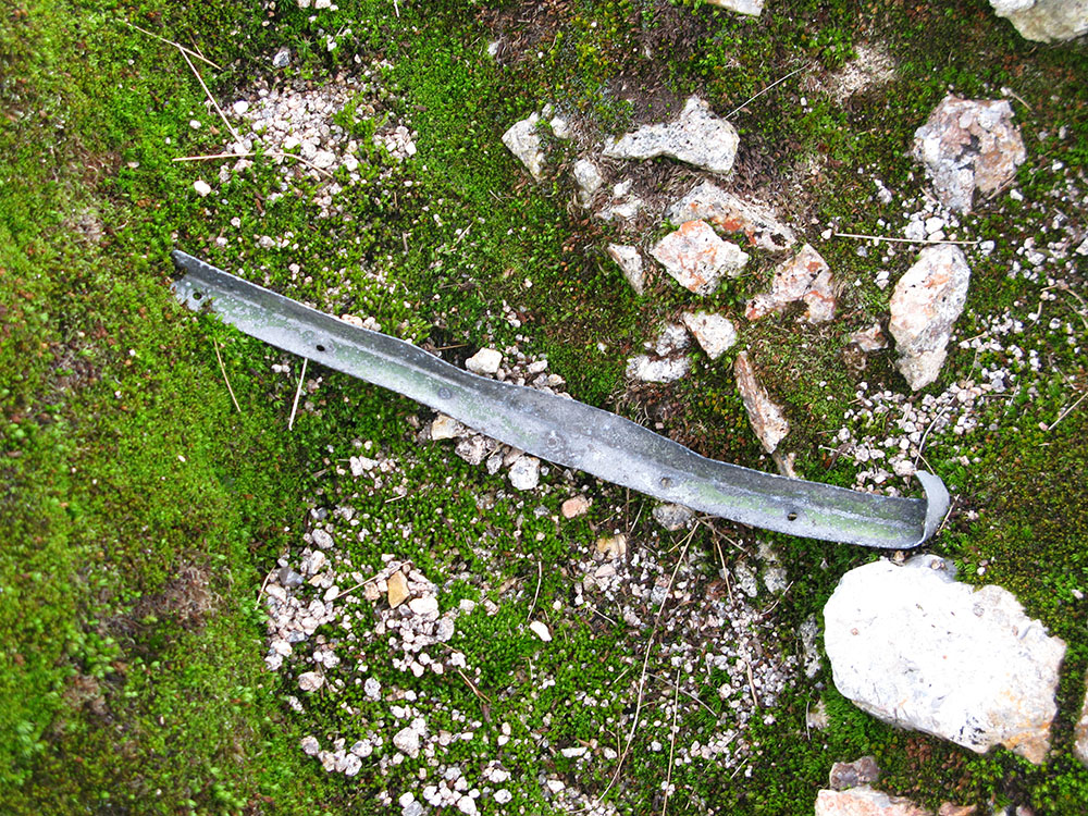
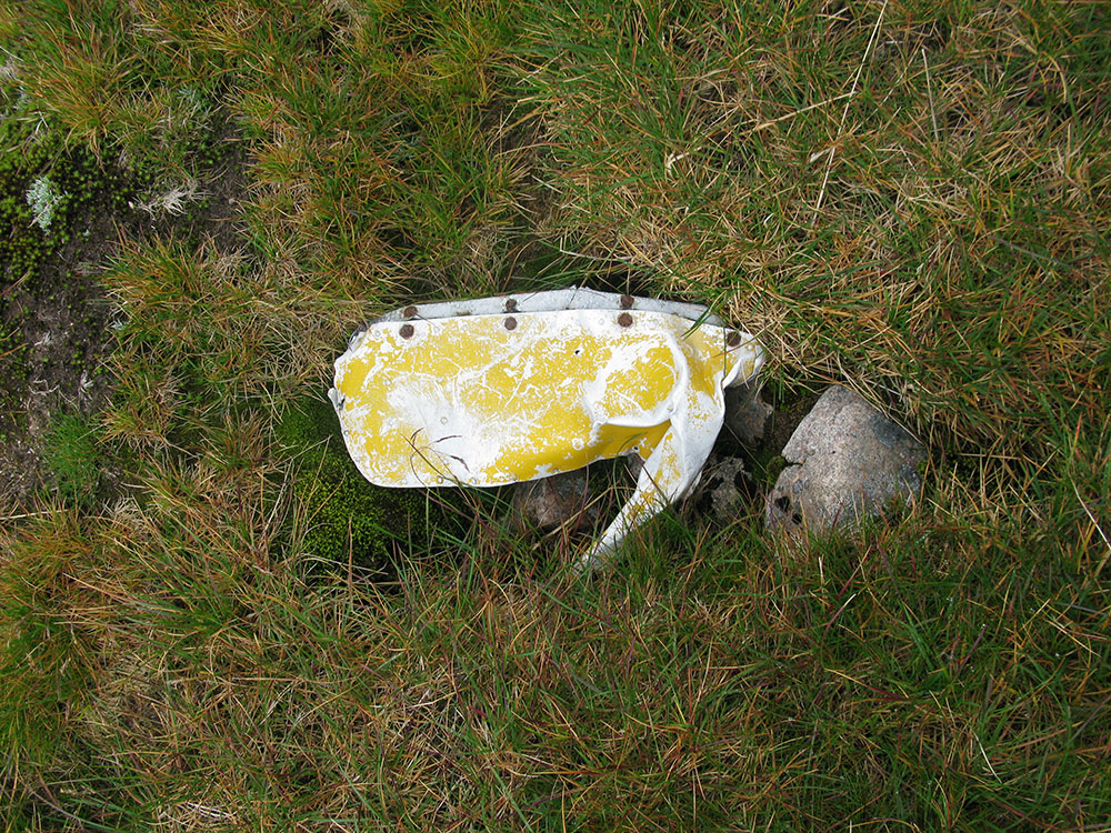
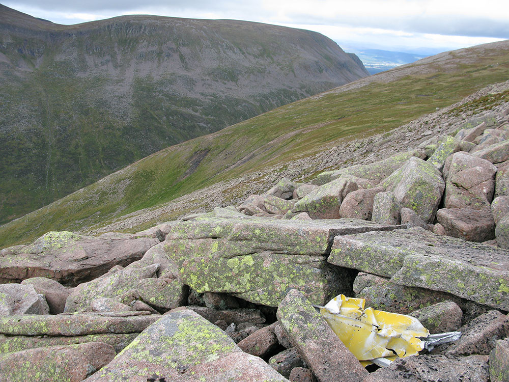
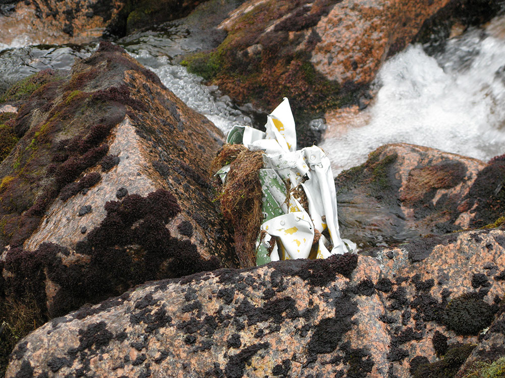
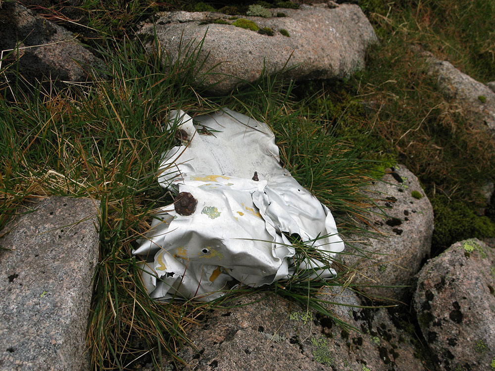
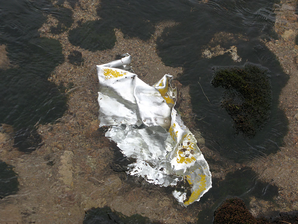
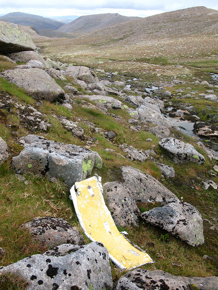
Update September 2013: During a further trip to the summit of Ben Macdui, I explored the Allt a'Choire Mhòir stream further and discovered more wreckage from the Anson, further to the west on steep bouldery ground where the stream falls towards the Lairig Ghru. There may be further wreckage to be discovered further down the slope. Some of this wreckage has identifiable yellow and blue-green paint on it, which matches up with some of the metal fragments found further to the east in the Snowy Corrie and near the Garbh Uisge Mòr river.
These pictures were taken in September 2013.
|
|
|
|
|
|
|
|
|
|
|
|
|
Update September 2013: I discovered another piece of debris with yellow paint on it, possibly from the Anson, in the Snowy Corrie to the east of the summit of Ben Macdui (1st photo from Sep 2013 below). I also discovered another piece of metal very similar to the 1st photo from Aug 2010 above, which I believe may come from the weather station that was sited on the summit plateau of Ben Macdui in 1956 (2nd photo from Sep 2013 below).
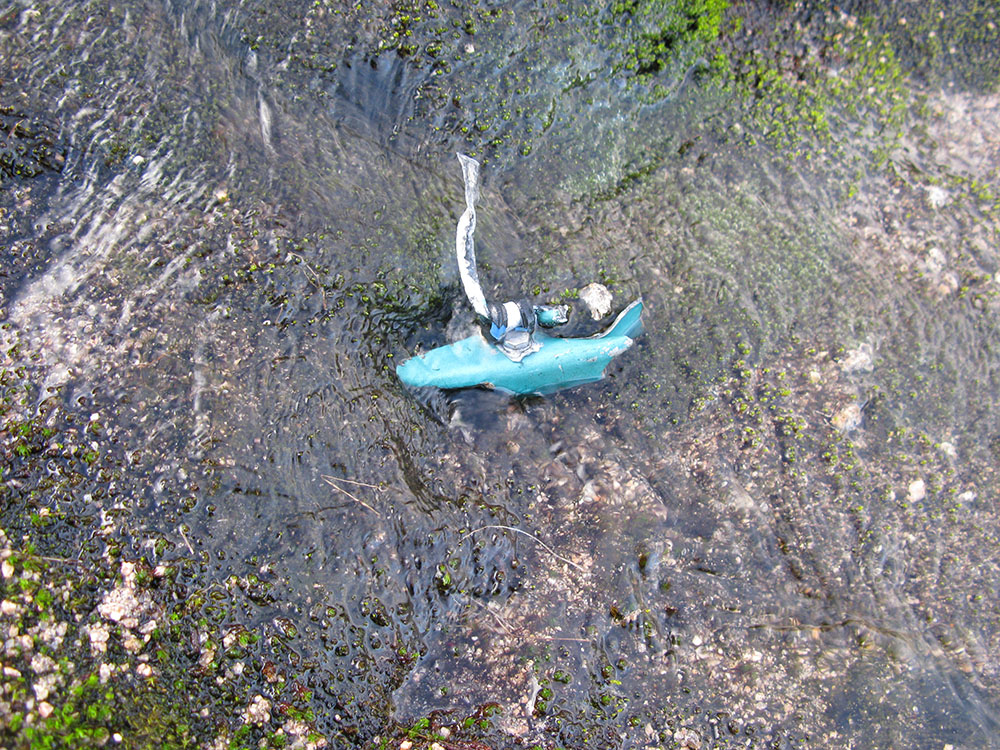
I also possibly located the metal fragment that Adam Watson mentioned (see above) that lies near a small lochan above Loch Etchachan - although this fragment was lying beside the lochan, not in it, as Adam describes (3rd and 4th photos from Sep 2013 below). Possibly someone, subsequent to Adam's observation in the late 70s/early 80s, has retrieved the fragment from the lochan. The metal fragment has blue-green paint on it, very similar to pieces in the Allt a'Choire Mhòir stream to the west.
If these fragments in the Snowy Corrie are from the Anson (and I believe they are), the complete debris field of the Anson is about 2km long, lying in a southwest-northeast direction across the Ben Macdui plateau. This would make it as long as the combined debris fields of the Airspeed Oxford and Bristol Blenheim on Braeriach to the west. The debris fields actually come close to each other in the Lairig Ghru and are about 1km apart; it is possible to envisage a walking route starting in Coire Beanaidh, descending to the Lairig Ghru via Coire Ruadh, ascending to the summit of Ben Macdui via the Allt a'Choire Mhòir, descending into the Snowy Corrie and following the Garbh Uisge Mòr towards Loch Etchachan, which would follow an almost continuous line of aircraft wreckage from 3 wartime crashes for about 6km.
Location of the sites:
OS 10-figure grid ref. NN 99439 99316, altitude 1180m
OS 10-figure grid ref. NN 99478 99348, altitude 1170m
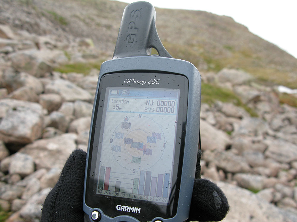
OS 10-figure grid ref. NJ 00038 00031, altitude 1060m (this site is coincidentally located a few metres from the notable OS grid ref of NJ 00000 00000, see photo here).These pictures were taken in September 2013.
|
|
|
|
National Museum of Flight, East Fortune.
|
|