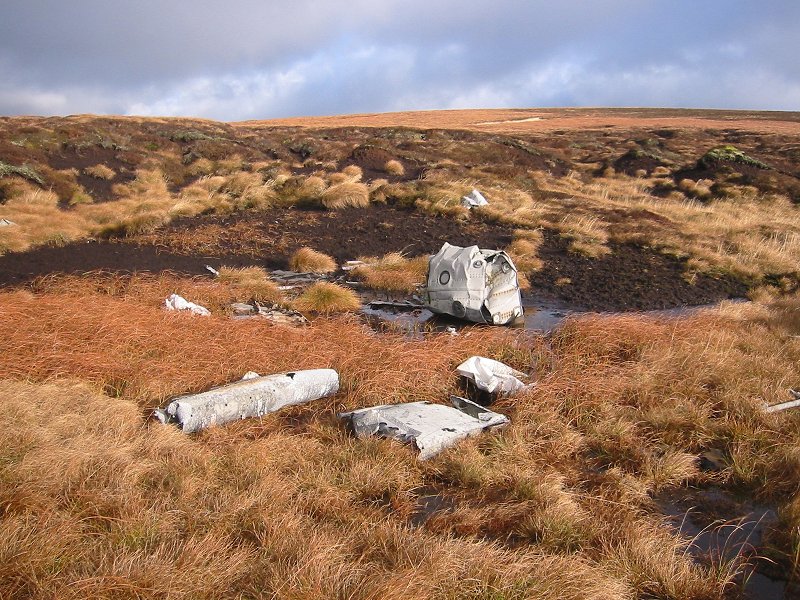
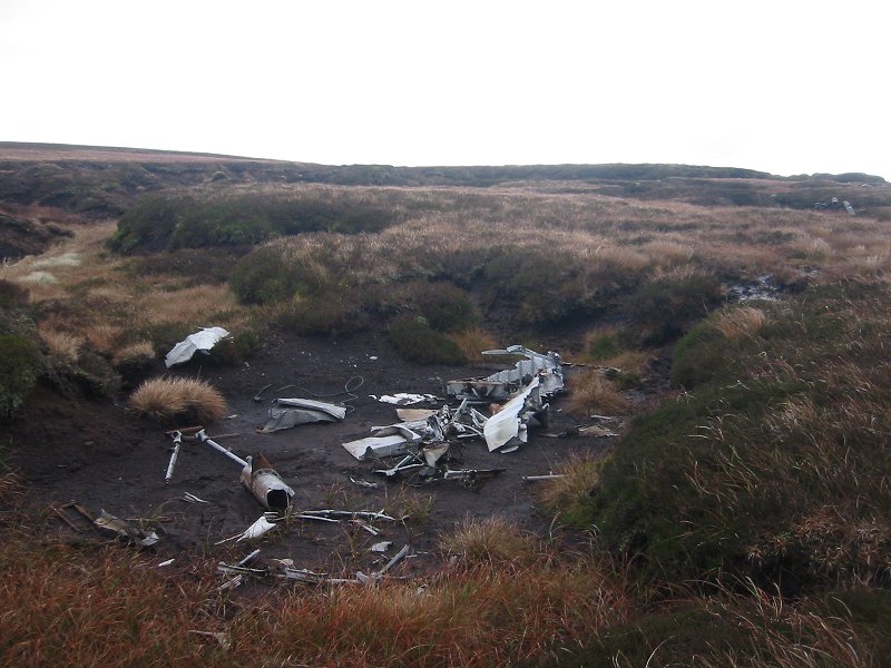
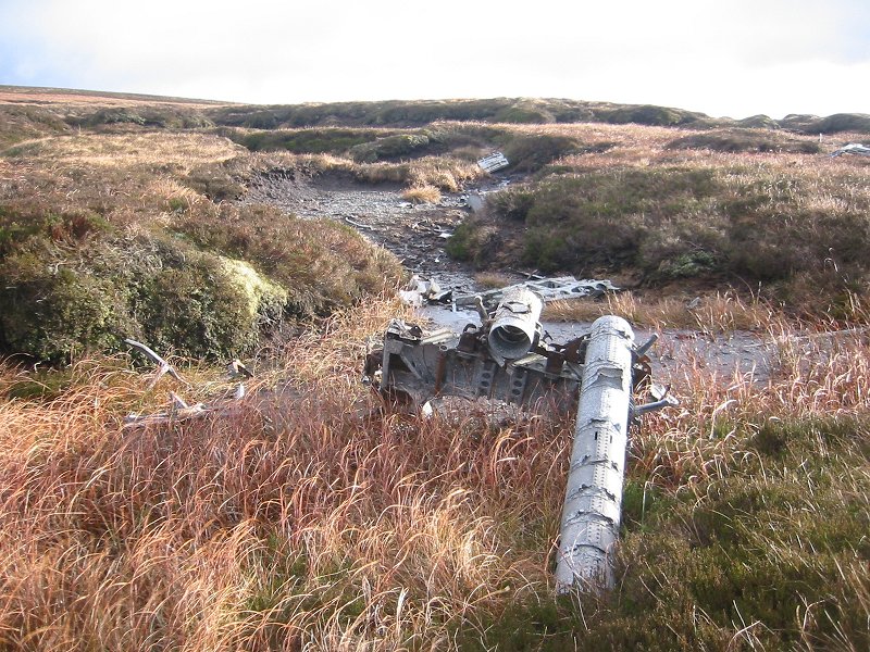
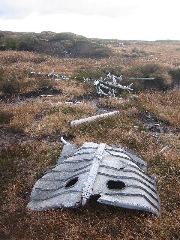
RAF Vickers Warwick, The Cheviot (just inside England), crash date 23/07/46

[Picture from wikipedia.org]OS 10-figure grid refs (GPS):
NT 89861 19579
NT 89894 19550
NT 89862 19482Google Maps display showing wreckage locations I discovered this wreck site serendipitously whilst on a walk to the summit of The Cheviot. The site is close to the main path to the summit on the western side of The Cheviot, between Auchope Cairn and Cairn Hill. The site is also only about 300m from the border between England and Scotland (and the route of the Pennine Way), and I'm including it in my list of Scottish wreckage sites even though it's technically in England.
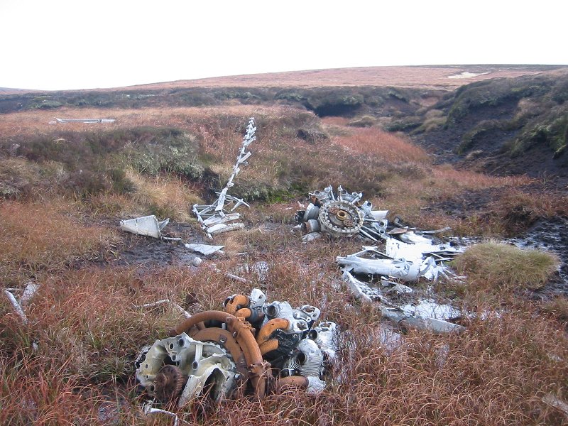
The wreckage lies at at an altitude of about 750m and there are large pieces of engine and fuselage sitting in boggy depressions between peat mounds. Pieces of the geodetic frame used to construct the Vickers Warwick are still visible.
The ACSS website has some information about the crash and photographs of the site here.
These pictures were taken in November 2007.
 |
 |
 |
|
 |
Update October 2008: I received a personal communication about this wreck from Bob Pitts. Bob lives in New Zealand now, but he was in a party of 3 teenagers who discovered this crash on the Cheviot on the afternoon of 30th July 1946. The Warwick had been reported missing for a week, and they were the first to come across the wreckage, and find the bodies of three airmen.
The story of this crash, and the discovery of it by Bob Pitts and his group, is covered in the HHG book.
Letter from Bob Pitts describing the discovery of the wreck here.