GPX format, 2575 points, 346 Kb
Google Earth KML file, 2575 points, 76 Kb
 Back to Home Page
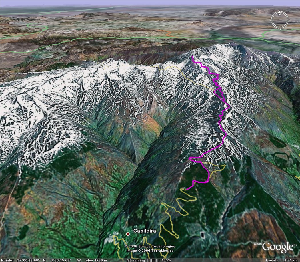
| Title Spain trip: Mulhacén | Click on thumbnail for Google Earth snapshot:
|
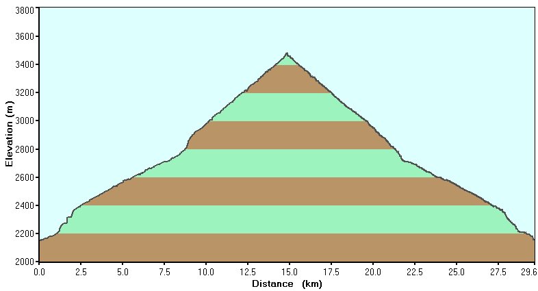
| Date 05/11/2006 | |
| Length 18.4 miles/ 29.6 km | |
| Start 0844 Finish 1735 | |
| Total time 8 hours 51 minutes | |
| Summits Mulhacén (3482m) | |
|
Download Spain trip GPS data (track only) GPX format, 2575 points, 346 Kb Google Earth KML file, 2575 points, 76 Kb |