GPX format, 1826 points, 246 Kb
Google Earth KML file, 1826 points, 53 Kb
 Back to Home Page
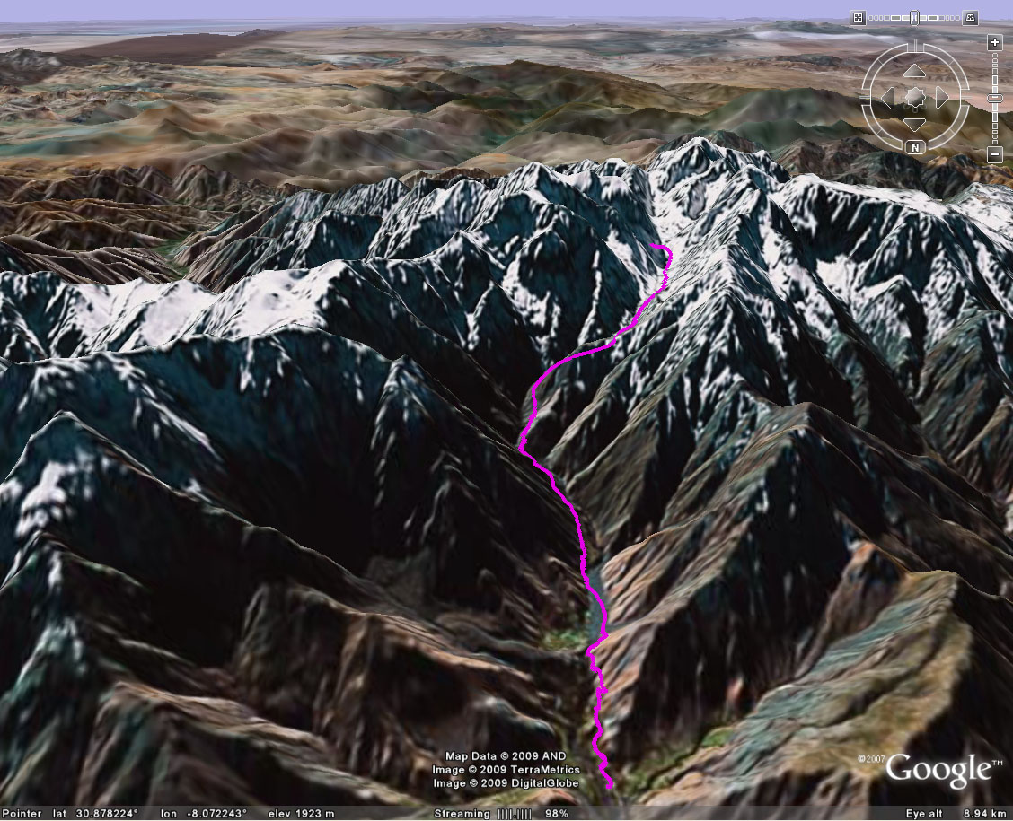
| Title Jbel Toubkal (Morocco) | Click on thumbnail for Google Earth snapshot:
|
| Date 30/01-01/02/2009 | |
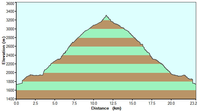
| Length 14.4 miles/ 23.2 km | |
| Start 1035 (30/01) Finish 1331 (01/02) | |
| Total time 2 days 2 hours 56 minutes (2 nights hut) | |
| Summits None (high point 3300m) | |
|
Download France trip GPS data (track only) GPX format, 1826 points, 246 Kb Google Earth KML file, 1826 points, 53 Kb |