GPX format, 1048 points, 140 Kb
Google Earth KML file, 1048 points, 30 Kb
 Back to Home Page
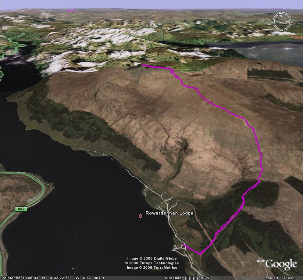
| Title Trip 10: Ben Lomond | Click on thumbnail for Google Earth snapshot:
|
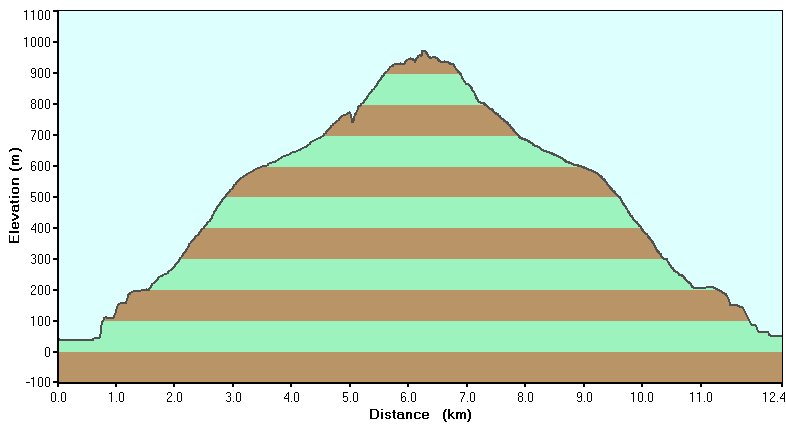
| Date 26/08/2006 | |
| Length 7.7 miles/ 12.4 km | |
| Start 1113 Finish 1618 | |
| Total time 5 hours 5 minutes | |
| Summits Ben Lomond (974m, M184) | |
|
Download trip 10 GPS data (track only) GPX format, 1048 points, 140 Kb Google Earth KML file, 1048 points, 30 Kb |