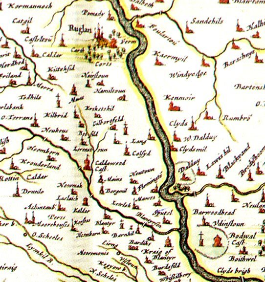
Old Maps
Thanks to National Library of Scotland and scotlandsplaces for allowing links to their websites
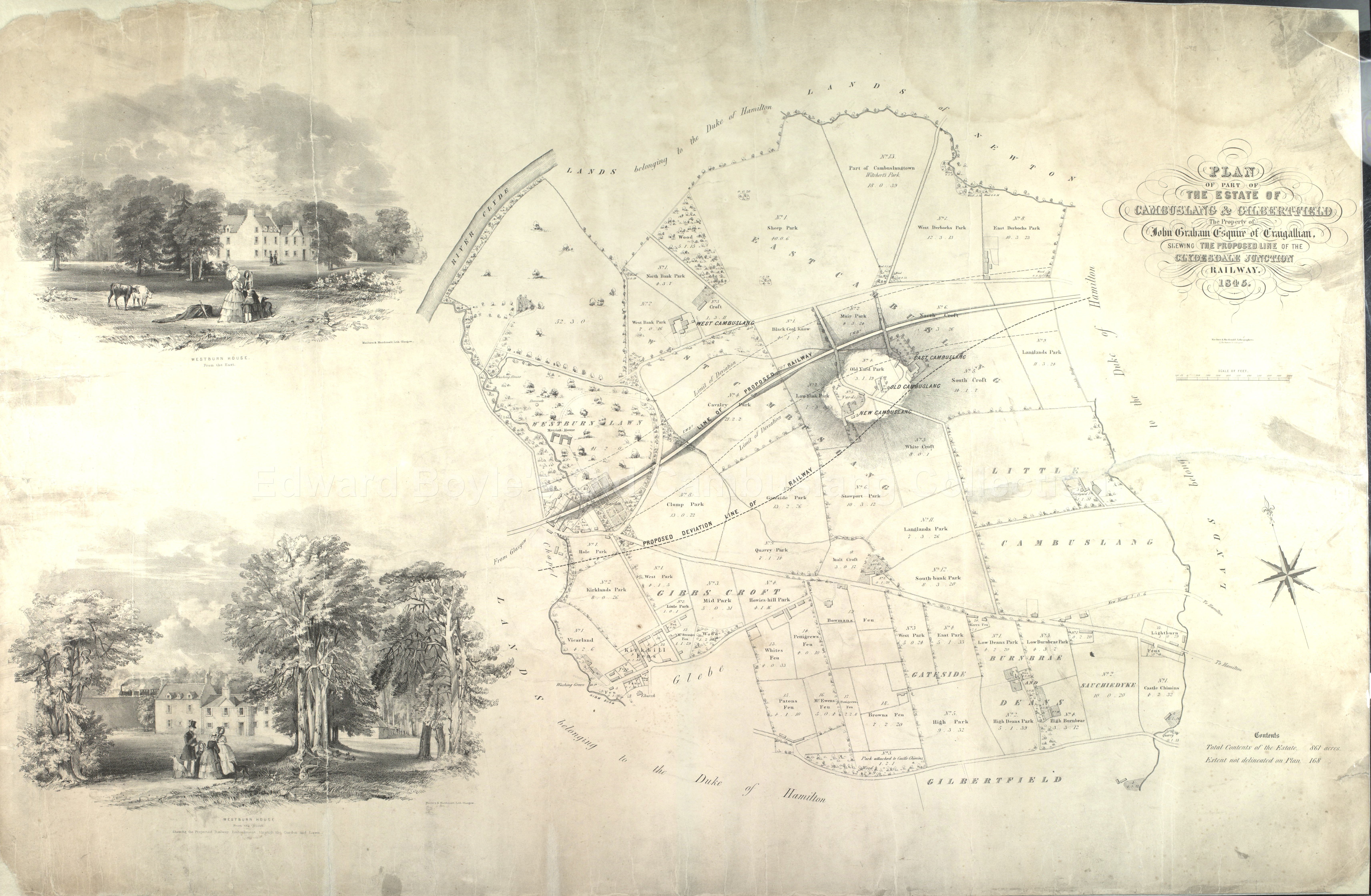
Plan
Of The Estate Of Cambuslang And Gilbertfield - External website
1845 Map showing proposed new railway line
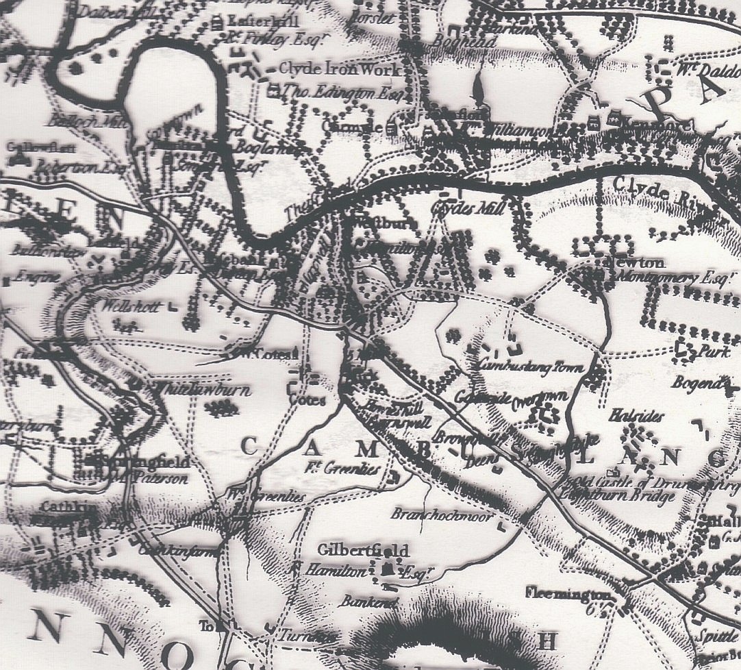
1859 - External website
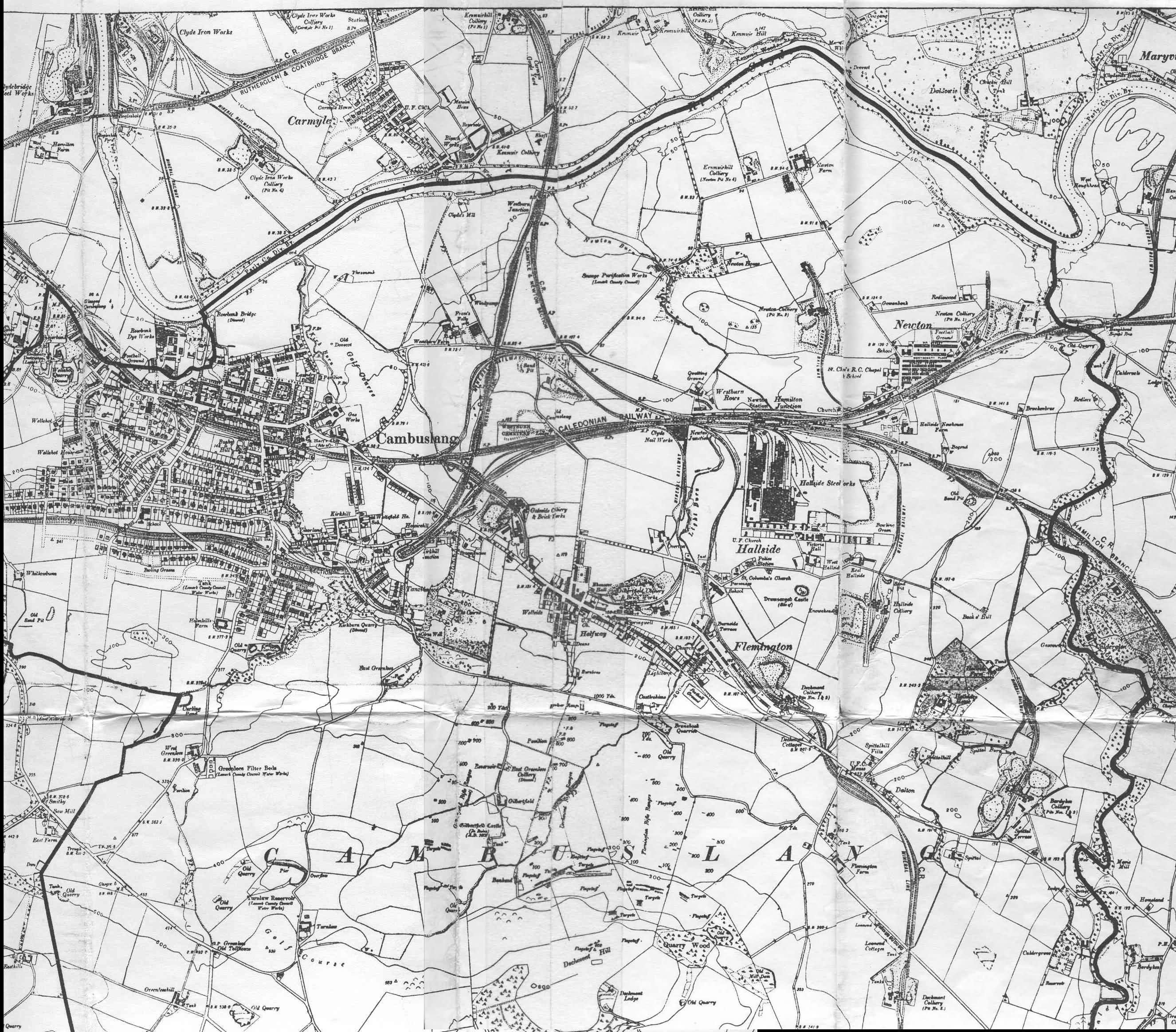
Date unknown Probably early 1900s. Shows town centre out to Bardykes colliery
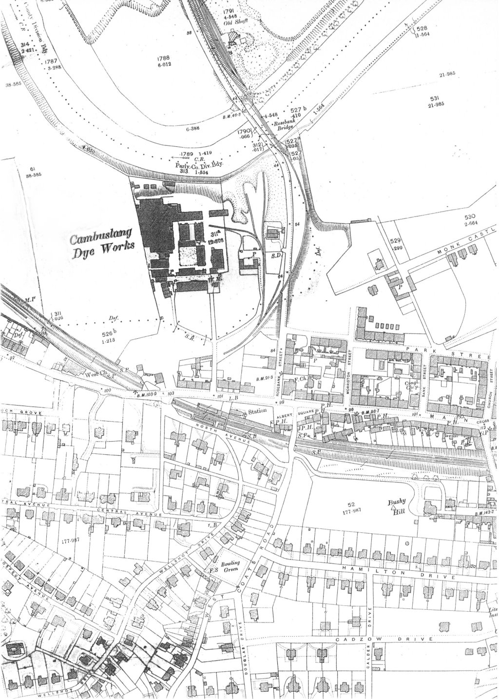
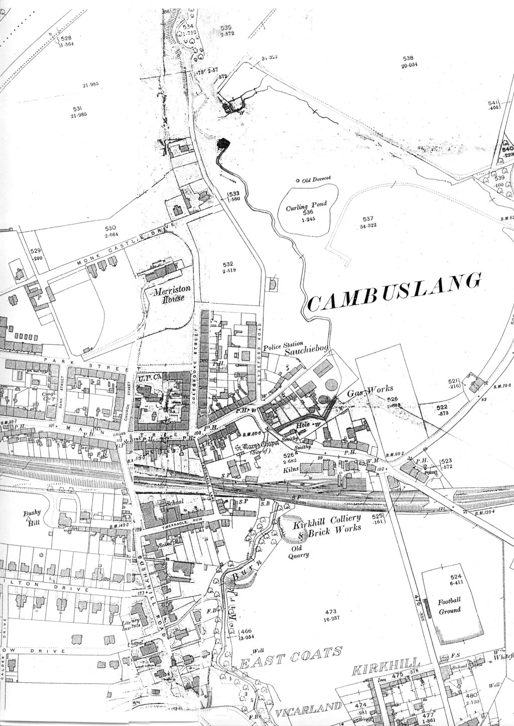
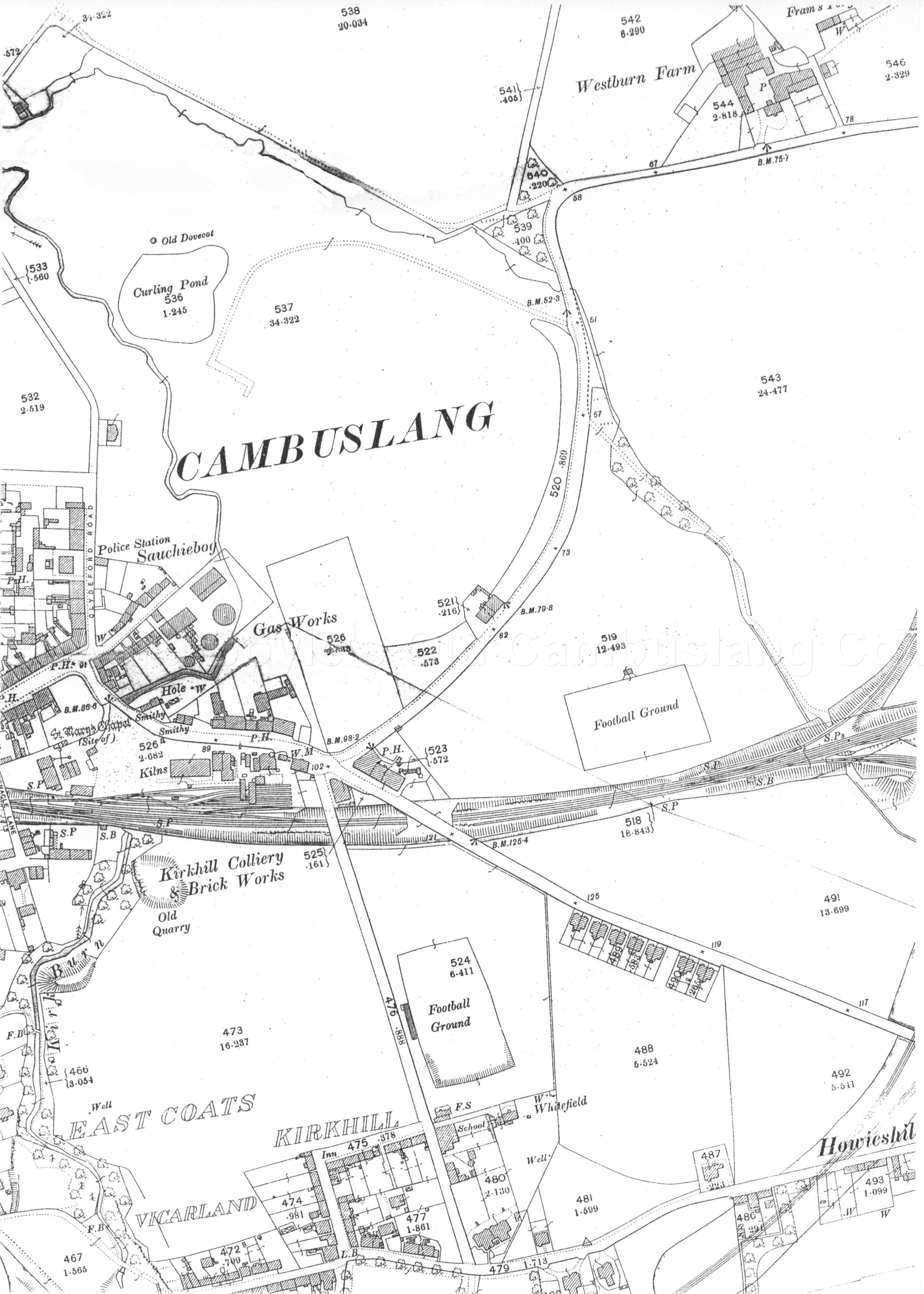
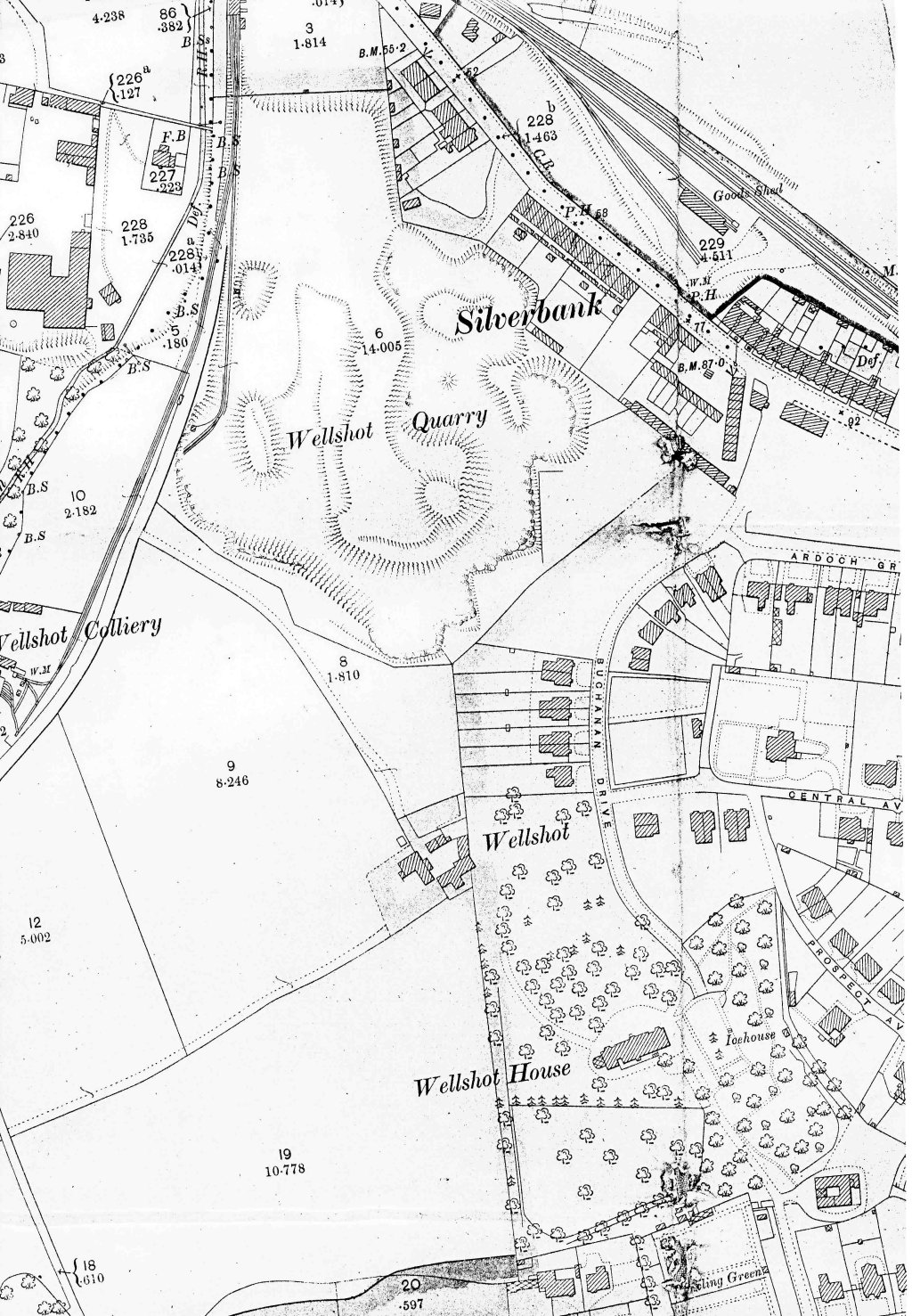
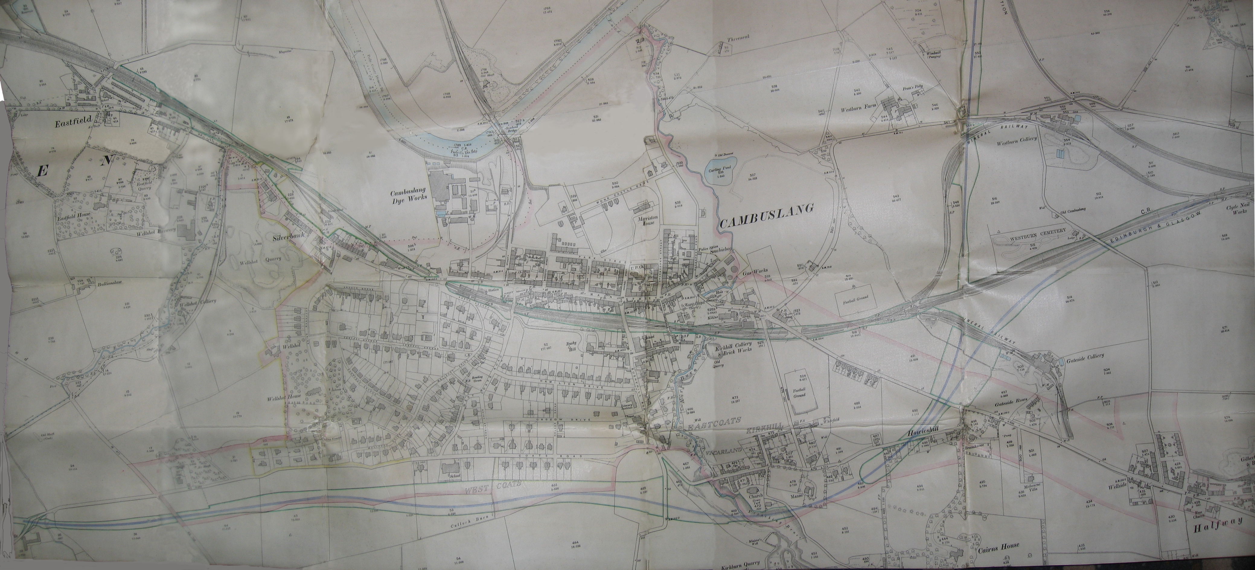
Following (big) maps compiled and donated by Colin Findlay, May 2004
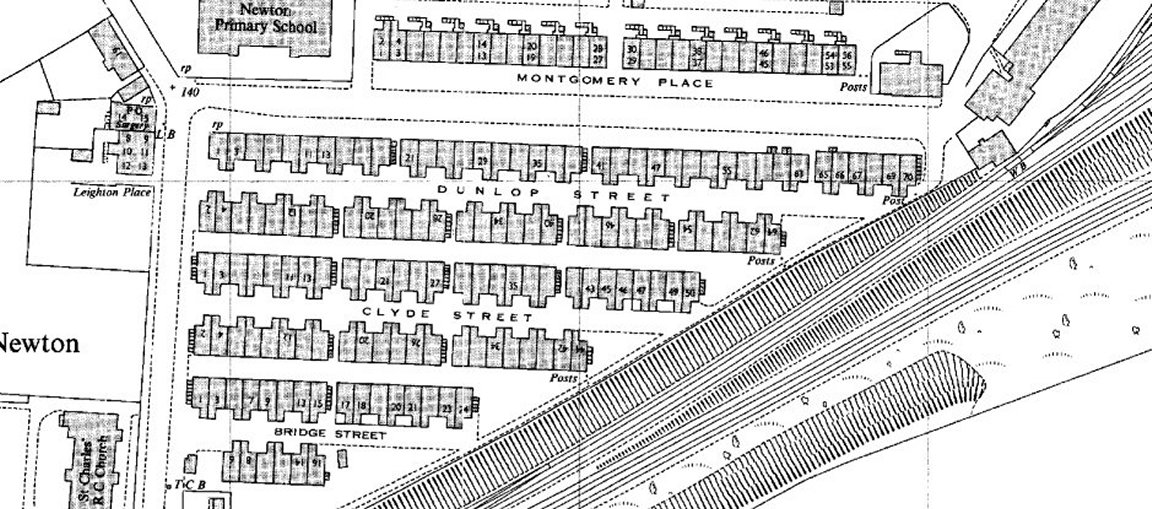
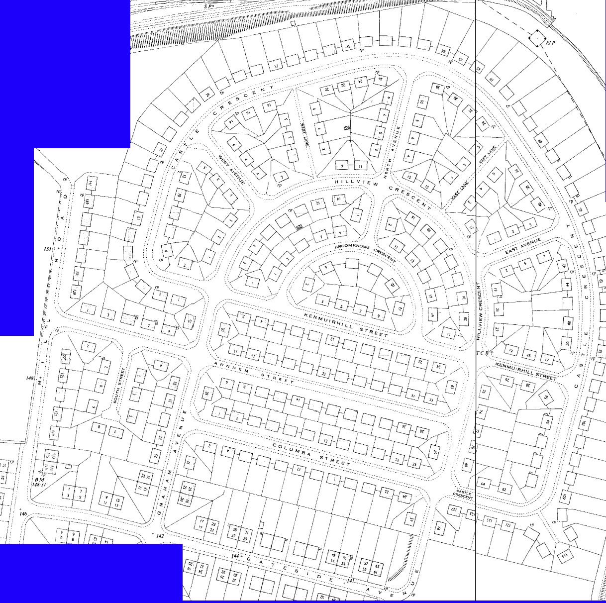
1895 map1 1895 map 2 1895 map 3 1895 map 4
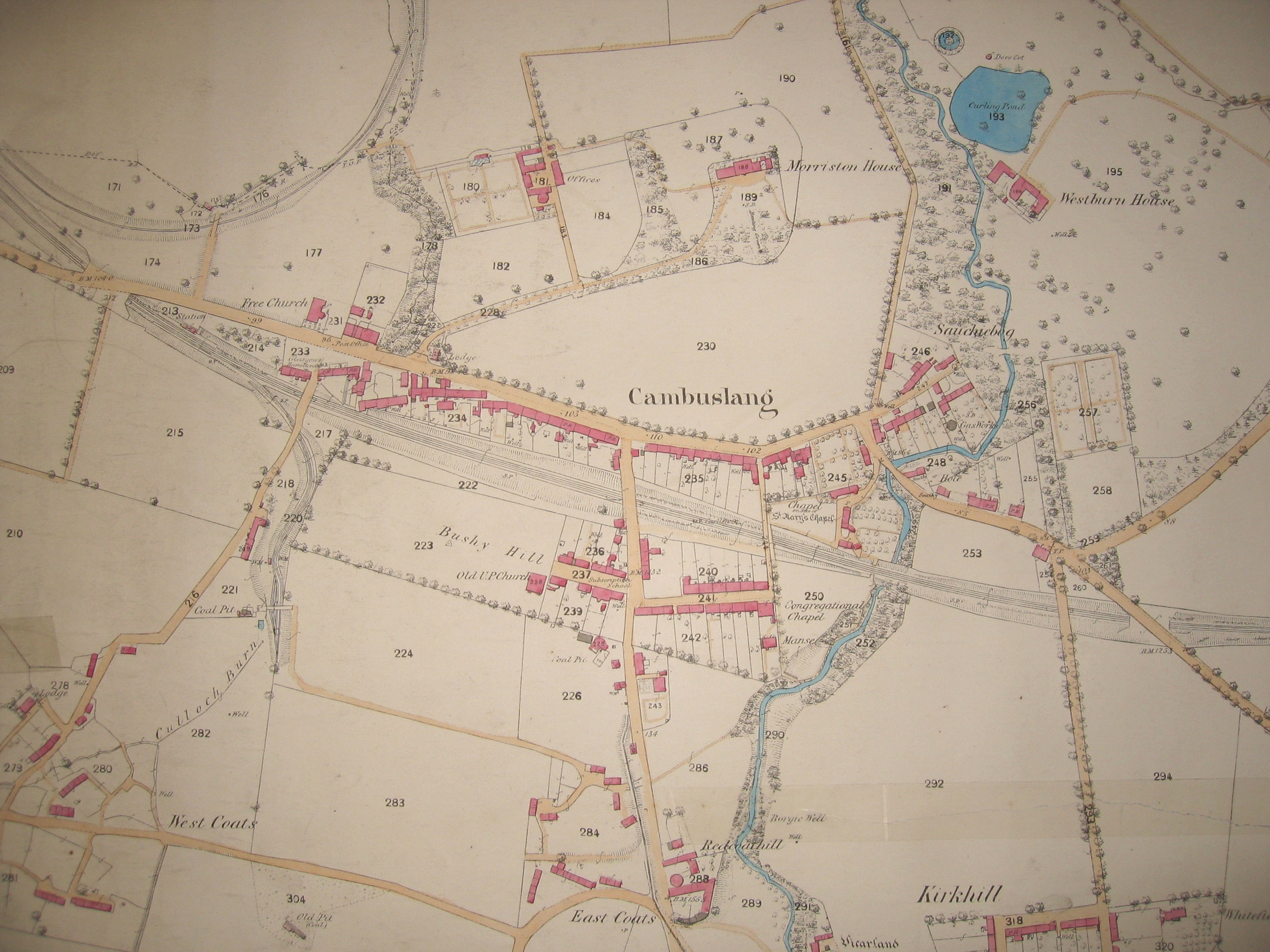
Another map of 1864 compiled and donated by Colin Findlay, Sep 2004
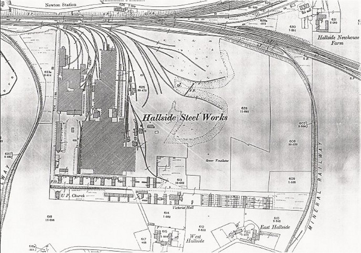
Hallside Steel Works 1898 - donated by John McGee May 05
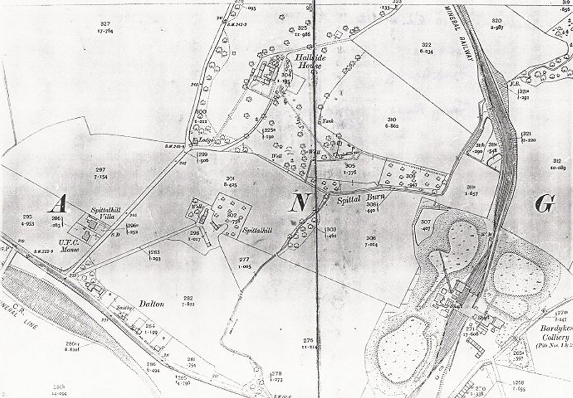
Spittal, Dalton and Bardykes colliery 1912 - donated by John McGee May 05
Barriage Ballon Sites WW2 (external site)
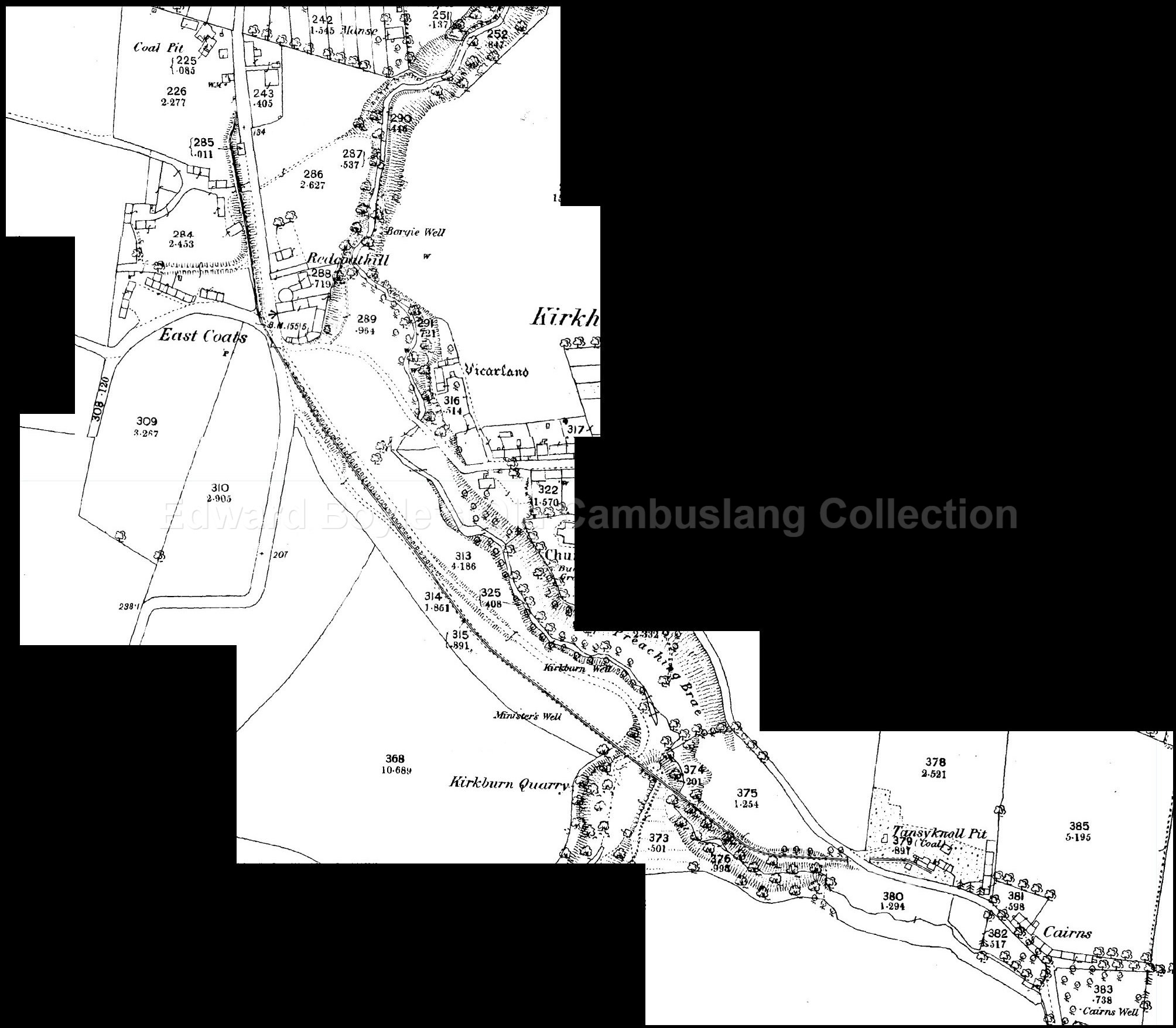
Mineral railway 1860. leading from Tansyknoll pit, via the (soon-to-be) public park, to the area where the institute now stands.
National Library of Scotland has old maps, up to 25 inch to the mile, overlaid on Google maps. You can select a map on the left and use the slider top left to show the present day Google map underneath with different levels of opacity.
(Suggested by Colin Findlay - Sep 2013)
Last updated 14 Sep 2020