AMATEUR historian, the late Jack Browning of Cathkin, takes an interesting look back on Cambuslang as you have probably never thought of it before — pre-dinosaurs!
I EXPECT most people will have read in the newspapers or watched on TV over the years the devastating loss of life and the destruction of property resulting from the earthquakes in Latin America.
But I wonder how many people are aware that the wee parish of Cambuslang suffered a catastrophe of similar intensity.
Fortunately, however, there was no loss of life or damage to property for the very reason that it occurred some 325 million years ago during the ‘Devonian’ period.
The area affected was a broad swathe some three miles in length. Suddenly the surface went into a state of convulsive upheaval. Barriers of rock appeared above the ground, while other sections collapsed and slid down to form deep hollows.
In the midst of this upheaval an area of ground, this time under extreme pressure, burst open. Volcanic ash and dust was thrown high into the air followed by streams of lava which solidified, forming the small volcano we now know as "Cathkin Brae."
The three-mile stretch in which this volcanic activity took place, was all the way from Dalton School to SilverBanks.
UPHILL
Now you may well wonder what all this volcanic activity of millions of years ago has to do with us today, but it actually does have a kind of relevance in our lives.
It's thanks to this activity that we that we frail mortals now have to walk uphill from places such as Hamilton Road in Halfway to Castle Chimmins, Deans Avenue and Gilbertfield Road. Every single step South from Hamilton Road is uphill in fact.
Of course the same uphill struggle has to be made up Howie's Hill and Croft Road and there is of course the "sair trackle" up Greenlees Road from Cambuslang Cross right up to Whitlawburn.
I'm sure the poor Kirkhill Golfers seldom think of the course as negotiating their way up, over and round Dechmont's volcanic out-crops of a game.
Another feature of the volcanic disaster was that the mining surveyors of the last century would require to site four of our local coal mines in a straight line. These were Spittal (Bardykes), Dechmont, Brandy and Gateside.
SOLID ROCK
Last but by no means least the railway engineers, when they arrived in 1848 to lay the rail track through Cambuslang would also have to contend with the after math of the volcanic upheaval.
Just stand for a moment on the railway bridge at Greenlees Road and look at the solid rock they had to blast their way through before the track could be sited and you'll see what I mean.
However, I wouldn't waste a lot of sympathy on them as they actually laid down the railway track in the wrong place! But that's another story!
Now Dechmont was firmly established and on guard, so to speak over what was eventually to become our parish. However, it had to waits some 50,000,000 years before there was any real change.
The most dramatic changes were in the area with the River Calder to the east, the River Clyde to the north and Eastfield to the West which had been a huge swampy marsh was now covered with tall tree like plants to the height of 50 feet and dense masses of ferns.
DECAY
The ferns we would certainly recognise today but these carboniferous trees, for that’s what they were, bore no resemblance to trees as we know them today.
The outer bark was soft and yielding while the interior too was of a soft, spongy texture. Another unusual feature was their rapid rate of growth and equally fast rate of decay.
This fast rate of growth and decay was to continue throughout the forest for centuries, with the inevitable result that the decayed vegetation under its own weight sank deep into the soft, yielding ground, there to become further decomposed and form peat, which would finally be come coal.
The black diamond which millions of years afterwards men would struggle, and often give their lives, to bring back to the surface.
So now we have nature, some 200 million years ago, creating a foundation of wealth for modern man and in his endeavour to recover this wealth, would transform a small rural community into a heavy industrialised parish with Cambuslang becoming the largest village in Scotland.
Now you may have noticed when I described the area in which the forest was growing that I made no reference to the area South of Dechmont, that is in the direction of East Kilbride. In this area there was very little carboniferous trees and ferns.
This is undoubtedly the reason why our near neighbour East Kilbride was allowed to retain its rural status throughout the industrial revolution.
What was to become one of the fastest growing communities in Scotland in the 1950's was at that time a huge forest.
While all this was taking place, Scotland, or rather what became of Scotland, was basking in the sunshine in the same area as Spain and Northern Africa. Just think, if we had stayed there sunbathing and summer holidays would have been a mailer of stepping out the door instead of the tedious and expensive business of hotels and air fares.
Alas it was not to be. The continental plate to which we were attached (with no English Channel at that time), started to move, albeit very slowly, and so we moved away from the warm hemisphere, finally settling more or less where we are today. Of course the result of the change in climate meant the complete disappearance of the coal forming carboniferous forest.
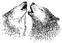
WOLVES
This scene of semi-desolation was to remain until a million years ago when Northern Europe became locked in the grip of the ice age.
So intense and prolonged was this period that the ice actually built up between two and three hundred metres thick. Another peculiar aspect of this phenomenon was the fact that during this time there would occur temperate periods when vegetation would appear. Animals such as polar bears, reindeer and wolves arrived only to disappear along with the vegetation as we again returned to a barren wilderness of ice.
The depth of the ice would have engulfed the tower blocks in Cambuslang, Springhall, Whitlawburn and Flemington.
As I explained earlier, nature had laid a very heavy hand on our parish, with twin volcanic eruptions and the movement of a huge glacier from the North-West.
The glacier moved through the gap between Ben Lomond and Dumgoyne Hill on the edge of the Campsies, travelling South-East.
It carved a path along the area now taking in Cambuslang golf course, along the edge of Westburn cemetery and Newton before it joined in the Lothians with the Forth glacier.
The route taken by the glacier through our Parish has been defined by a number of 100 foot beaches created by the scouring action as it moved, sweeping large quantities of loose soil, rubble and rocks before depositing the debris in some cases miles from their original site.
Now here I want to digress, just a little and make reference 'to two large boulders which can be found locally, One is located on a grass square at Cambuslang terminus. The other boulder sits about 50 yards from the Bel-Air public house in Whitlawburn.
A glance at these boulders will reveal their peripheries are as smooth as the palm of your hand. Now this smoothness is typical of rocks which have been unseated, rolled and polished by the action of moving ice.
BURDEN
As for the 100 foot beaches I shall mention just a few places where you will be able to see one.
If you walk down Somerville Street from Main Street, Cambuslang to the Orion Bridge, believe it or not you are actually walking down a beach.
Again if you travel from St. Andrew's Church to the Golf Club House and walk down from the traffic lights at the junction of Westburn Road, past the Circuit housing scheme, you are once again on a beach.
In Mill Road, Halfway, the beach is the-walk from the Railway Bridge to Westburn Road, as is the walk from Hallside Village to Newton Station and finally the walk above Boers Road from Gowan Bank House to Newton Farm.
But what of the remainder of the Parish which for thousands of years lay prostrate under the heavy burden of thick ice. Well at long last when the ice did finally receded the bare landscape revealed "Drumlins" dotted all over the place.
By the way, the word "Drumlin" I have been told is the Irish word meaning "small hill", and our parish has more than its fair share of these small hills or hillocks as we say in Scotland.
In fact, I don't think there is a square mile of level ground anywhere in our district.
Try it yourself; walk for a few moments and sure enough, you find you are either walking; gently uphill or downhill
PREDATOR
What a rich and peaceful habitat that must have been for the animals, such as the Caledonian Bear, wolves and foxes, badgers, right down to the field mouse.
And what of the birds? Well, we could boast of nearly every species from the mighty buzzard to the humble sparrow. No doubt the Rivers Clyde and Calder would teem with a variety of fish.
That, then, was nature's contribution. But alas like all good things, it had to end, and end it did –some 2000 years ago with the arrival of the greatest predator of all — man. Consequently the peace and tranquility was broken for all time.
Ever restless, never satisfied, always seeking to change — our first parishoners had arrived. Soon, trees were felled to make space for their dwellings.
And cattle, wild creatures which had roamed freely for centuries, now found themselves being hunted and killed.
So, Just as it had in our distant past, the process of change was about to begin all over again.
But now man, and not nature’s elements, would be the principal architect.